

71
radar reflectors, lightning rods, and even bells or foghorns in high traffic areas
subject to frequent fogs. GPS capability alerts to loss of station keeping and allows
tracking of buoys accidentally set adrift. Buoy software is programmed to send
emails or place cellular telephone calls if the GPS signal is outside the buoys preestablished watch radius.
Buoys are equipped with watertight payload bays housing batteries and electronics and communications equipment. Instrument towers or masts bear meteorological
sensors, antennae, foghorns, radar reflectors, lighting rods, and other instruments.
NOAA’s National Data Buoy Center (NDBC) operates a wide variety of data
buoys ranging from small 1.5 diameter COLOS buoys for inshore waters to the
large 12 m diameter offshore DISCUS buoys. While primarily meteorological,
NDBC buoys usually bear wave-sensing accelerometers and instruments for measuring surface seawater temperature and salinity. Deep water ODAS moorings
incorporate several additional features such as extended lengths of buoyant polypropylene rope along the mooring line. Judiciously positioned subsurface buoys and
lead sinkers achieve additional resilience to wave action through the formation of
running-S inverse catenary forms.
Incorporating most elements described, the Gulf of Maine Ocean Observing
System (GoMOOS) ODAS moored buoys (Wallinga et al. 2003) have been successfully deployed in the Gulf of Maine, the Yucatan Channel, and Caribbean and
Atlantic waters of Puerto Rico and the Virgin Islands. These buoys are routinely
recovered, refurbished, and redeployed, and instruments are replaced with freshly
recalibrated units (Fig. 3.2).
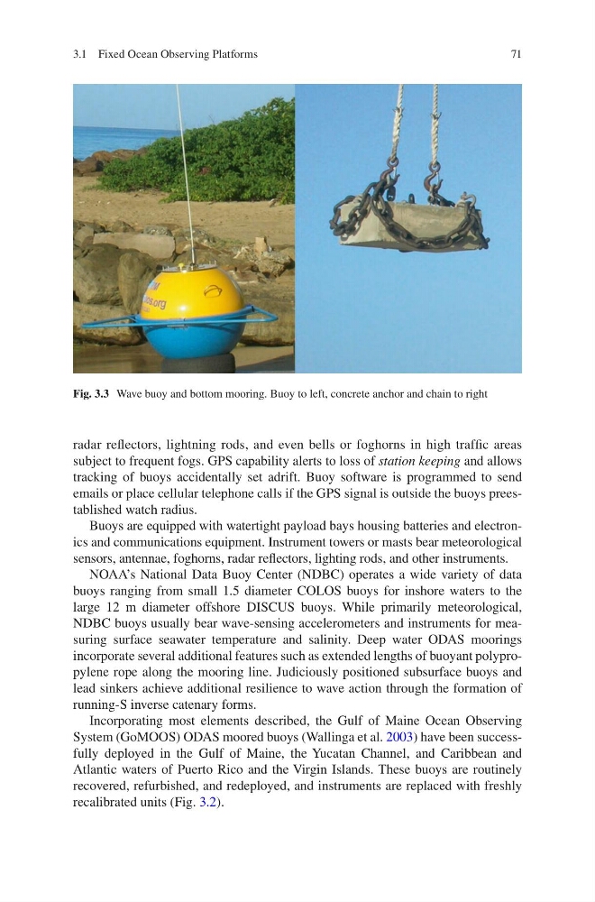
Fig. 3.3 Wave buoy and bottom mooring. Buoy to left, concrete anchor and chain to right
3.1 Fixed Ocean Observing Platforms
radar reflectors, lightning rods, and even bells or foghorns in high traffic areas
subject to frequent fogs. GPS capability alerts to loss of station keeping and allows
tracking of buoys accidentally set adrift. Buoy software is programmed to send
emails or place cellular telephone calls if the GPS signal is outside the buoys preestablished watch radius.
Buoys are equipped with watertight payload bays housing batteries and electronics and communications equipment. Instrument towers or masts bear meteorological
sensors, antennae, foghorns, radar reflectors, lighting rods, and other instruments.
NOAA’s National Data Buoy Center (NDBC) operates a wide variety of data
buoys ranging from small 1.5 diameter COLOS buoys for inshore waters to the
large 12 m diameter offshore DISCUS buoys. While primarily meteorological,
NDBC buoys usually bear wave-sensing accelerometers and instruments for measuring surface seawater temperature and salinity. Deep water ODAS moorings
incorporate several additional features such as extended lengths of buoyant polypropylene rope along the mooring line. Judiciously positioned subsurface buoys and
lead sinkers achieve additional resilience to wave action through the formation of
running-S inverse catenary forms.
Incorporating most elements described, the Gulf of Maine Ocean Observing
System (GoMOOS) ODAS moored buoys (Wallinga et al. 2003) have been successfully deployed in the Gulf of Maine, the Yucatan Channel, and Caribbean and
Atlantic waters of Puerto Rico and the Virgin Islands. These buoys are routinely
recovered, refurbished, and redeployed, and instruments are replaced with freshly
recalibrated units (Fig. 3.2).
Fig. 3.3 Wave buoy and bottom mooring. Buoy to left, concrete anchor and chain to right
3.1 Fixed Ocean Observing Platforms