

152 Sea Level Processes and Effects of Sea Level Change
Aflil't'lIlIf
- n -:I
POUR
VENlS€
UNESCO
lOOF REPUBUQUE TOGOLAISE
OtO
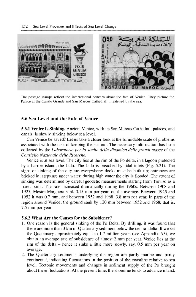
The postage stamps reflect the international concern about the fate of Venice. They picture the
Palace at the Canale Grande and San Marcus Cathedral, threatened by the sea.
5.6 Sea Level and the Fate of Venice
5.6.1 Venice Is Sinking. Ancient Venice, with its San Marcus Cathedral, palaces, and
canals, is slowly sinking below sea level.
Can Venice be saved? Let us take a closer look at the fonnidable scale of problems
associated with the task of keeping the sea out. The necessary infonnation has been
collected by the Laboratorio per 10 studio della dinamica delle grandi masse of the
Consiglio Nazionale delle Ricerche.
Venice is at sea level. The city lies at the rim of the Po delta, in a lagoon protected
by a barrier island, the Lido. The Lido is breached by tidal inlets (Fig. 5.21). The
signs of sinking of the city are everywhere: docks must be built up; entrances are
bricked in; steps are under water; during high water the city is flooded. The extent of
sinking was detennined by careful geodetic measurements starting from Treviso as a
fixed point. The rate increased dramatically during the 1960s. Between 1908 and
1925, Mestre-Marghera sank 0.15 mm per year, on the average. Between 1925 and
1952 it was 0.7 mm, and between 1952 and 1968, 3.8 mm per year. In parts of the
region around Venice, the ground sank by 120 mm between 1952 and 1968, that is,
7.5 mm per year!
5.6.2 What Are the Causes for the Subsidence?
I. One reason is the general sinking of the Po Delta. By drilling, it was found that
there are more than 3 km of Quaternary sediment below the central delta. If we set
the Quaternary approximately equal to 1.7 million years (see Appendix A3), we
obtain an average rate of subsidence of almost 2 mm per year. Venice lies at the
rim of the delta - hence it sinks a little more slowly, say, 0.5 mm per year on
average.
2. The Quaternary sediments underlying the region are partly marine and partly
continental, indicating fluctuations in the position of the coastline relative to sea
level. Tectonic movements and changes in sediment supply of the Po brought
about these fluctuations . At the present time, the shoreline tends to advance inland.
Aflil't'lIlIf
- n -:I
POUR
VENlS€
UNESCO
lOOF REPUBUQUE TOGOLAISE
OtO
The postage stamps reflect the international concern about the fate of Venice. They picture the
Palace at the Canale Grande and San Marcus Cathedral, threatened by the sea.
5.6 Sea Level and the Fate of Venice
5.6.1 Venice Is Sinking. Ancient Venice, with its San Marcus Cathedral, palaces, and
canals, is slowly sinking below sea level.
Can Venice be saved? Let us take a closer look at the fonnidable scale of problems
associated with the task of keeping the sea out. The necessary infonnation has been
collected by the Laboratorio per 10 studio della dinamica delle grandi masse of the
Consiglio Nazionale delle Ricerche.
Venice is at sea level. The city lies at the rim of the Po delta, in a lagoon protected
by a barrier island, the Lido. The Lido is breached by tidal inlets (Fig. 5.21). The
signs of sinking of the city are everywhere: docks must be built up; entrances are
bricked in; steps are under water; during high water the city is flooded. The extent of
sinking was detennined by careful geodetic measurements starting from Treviso as a
fixed point. The rate increased dramatically during the 1960s. Between 1908 and
1925, Mestre-Marghera sank 0.15 mm per year, on the average. Between 1925 and
1952 it was 0.7 mm, and between 1952 and 1968, 3.8 mm per year. In parts of the
region around Venice, the ground sank by 120 mm between 1952 and 1968, that is,
7.5 mm per year!
5.6.2 What Are the Causes for the Subsidence?
I. One reason is the general sinking of the Po Delta. By drilling, it was found that
there are more than 3 km of Quaternary sediment below the central delta. If we set
the Quaternary approximately equal to 1.7 million years (see Appendix A3), we
obtain an average rate of subsidence of almost 2 mm per year. Venice lies at the
rim of the delta - hence it sinks a little more slowly, say, 0.5 mm per year on
average.
2. The Quaternary sediments underlying the region are partly marine and partly
continental, indicating fluctuations in the position of the coastline relative to sea
level. Tectonic movements and changes in sediment supply of the Po brought
about these fluctuations . At the present time, the shoreline tends to advance inland.