

Model Development for Passive Microwave Remote Sensing ...
587
Mapping of wet snow is more difficult, as slightly wet soils, wet snow and open water have
similar emissivities. The relations proposed by Pulliainen et. al. (1990)
T37V > 263 K,
(21.15)
IT37V - Tl9VI < 3 K,
(21.16)
12K < T19V - T19H < 33 K,
(21.17)
IT19V - T19H - 1.4 * (T37V - T37 H) I < 3 K,
(21.18)
have all to be true in order to exclude false detections.
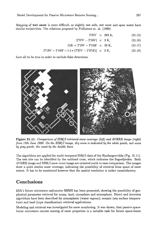
Figure 21.11: Comparison of SSM/I retrieved snow coverage (left) and AVHRR image (right)
from 13th June 1990. On the SSM/I image, dry snow is indicated by the white pixels, wet snow
by gray pixels, the coast by the double lines.
The algorithms are applied for multi-temporal SSMjI data of the Hardangervidda (Fig. 21.11).
The test site can be identified by the outlined cross, which indicates the Sognefjorden. Both
AVHRR image and SSMjI snow cover image are oriented north to ease comparison. The images
show a quite similar snow coverage, indicating the possibility of retrieval from space of snow
extent. It has to be mentioned however that the spatial resolution is rather unsatisfactory.
Conclusions
ESA's future microwave radiometer MIMR has been presented, showing the possibility of geophysical parameter retrieval for ocean, land, cryosphere and atmosphere. Direct and inversion
algorithms have been described for atmospheric (water vapour), oceanic (sea surface temperature) and land (type classification) retrieval applications.
Modeling and retrieval was investigated for snow monitoring. It was shown, that passive spaceborne microwave remote sensing of snow properties is a suitable task for future space-borne