

574
J. Noll
Parameter
primary
spatial
range of
expected RMS
frequency [GHz] resolution [km]
values
accuracy
SST
6.8/10.65
85
-2 to 35 C
0.5K
Wind speed
36.5/10.65
15/55 *1
0- 40 m/s
1.5 m/s
Water vapour
23.8
25
o to 70 mm 1 mm
Water vapour
18.7/23.8/36.5
25
o to 15 mm 0.5mm
column (500m)
in PBL
Liquid Water
36.5/89
15
Oto1mm
0.05 mm
Column
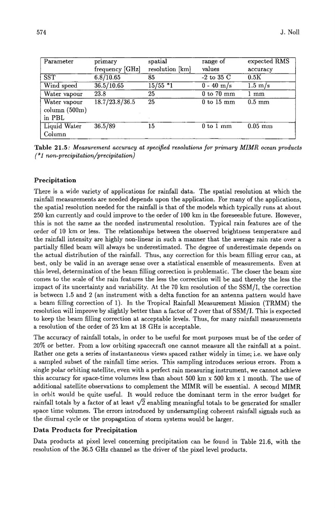
Table 21.5: Measurement accuracy at specified resolutions for primary MIMR ocean products
(*1 non-precipitation/precipitation)
Precipitation
There is a wide variety of applications for rainfall data. The spatial resolution at which the
rainfall measurements are needed depends upon the application. For many of the applications,
the spatial resolution needed for the rainfall is that of the models which typically runs at about
250 km currently and could improve to the order of 100 km in the foreseeable future. However,
this is not the same as the needed instrumental resolution. Typical rain features are of the
order of 10 km or less. The relationships between the observed brightness temperature and
the rainfall intensity are highly non-linear in such a manner that the average rain rate over a
partially filled beam will always be underestimated. The degree of underestimate depends on
the actual distribution of the rainfall. Thus, any correction for this beam filling error can, at
best, only be valid in an average sense over a statistical ensemble of measurements. Even at
this level, determination of the beam filling correction is problematic. The closer the beam size
comes to the scale of the rain features the less the correction will be and thereby the less the
impact of its uncertainty and variability. At the 70 km resolution of the SSM/I, the correction
is between 1.5 and 2 (an instrument with a delta function for an antenna pattern would have
a beam filling correction of 1). In the Tropical Rainfall Measurement Mission (TRMM) the
resolution will improve by slightly better than a factor of 2 over that of SSM/I. This is expected
to keep the beam filling correction at acceptable levels. Thus, for many rainfall measurements
a resolution of the order of 25 km at 18 GHz is acceptable.
The accuracy of rainfall totals, in order to be useful for most purposes must be of the order of
20% or better. From a low orbiting spacecraft one cannot measure all the rainfall at a point.
Rather one gets a series of instantaneous views spaced rather widely in time; i.e. we have only
a sampled subset of the rainfall time series. This sampling introduces serious errors. From a
single polar orbiting satellite, even with a perfect rain measuring instrument, we cannot achieve
this accuracy for space-time volumes less than about 500 km x 500 km x 1 month. The use of
additional satellite observations to complement the MIMR will be essential. A second MIMR
in orbit would be quite useful. It would reduce the dominant term in the error budget for
rainfall totals by a factor of at least v'2 enabling meaningful totals to be generated for smaller
space time volumes. The errors introduced by undersampling coherent rainfall signals such as
the diurnal cycle or the propagation of storm systems would be larger.
Data Products for Precipitation
Data products at pixel level concerning precipitation can be found in Table 21.6, with the
resolution of the 36.5 GHz channel as the driver of the pixel level products.