

3 Methodology
A methodology has been developed for understanding and accomplishing the
objectives of this chapter in two separate parts as seen below.
3.1 Part 1: Methodology for the First Objective
The methodology for detection and assessment of climate change in Jadigenahalli
comprises the following major steps:
1. To develop a spatially linked indicator database for detecting climate change
evidence.
2. To form an index for measuring the extent of climate change.
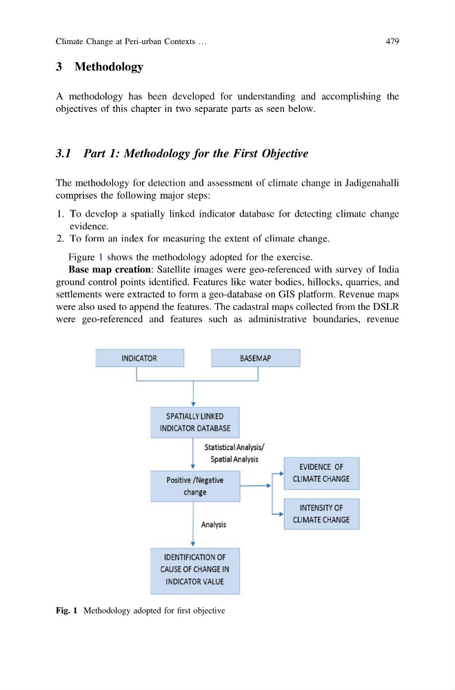
Figure 1 shows the methodology adopted for the exercise.
Base map creation: Satellite images were geo-referenced with survey of India
ground control points identified. Features like water bodies, hillocks, quarries, and
settlements were extracted to form a geo-database on GIS platform. Revenue maps
were also used to append the features. The cadastral maps collected from the DSLR
were geo-referenced and features such as administrative boundaries, revenue
Fig. 1 Methodology adopted for first objective
Climate Change at Peri-urban Contexts …
479
A methodology has been developed for understanding and accomplishing the
objectives of this chapter in two separate parts as seen below.
3.1 Part 1: Methodology for the First Objective
The methodology for detection and assessment of climate change in Jadigenahalli
comprises the following major steps:
1. To develop a spatially linked indicator database for detecting climate change
evidence.
2. To form an index for measuring the extent of climate change.
Figure 1 shows the methodology adopted for the exercise.
Base map creation: Satellite images were geo-referenced with survey of India
ground control points identified. Features like water bodies, hillocks, quarries, and
settlements were extracted to form a geo-database on GIS platform. Revenue maps
were also used to append the features. The cadastral maps collected from the DSLR
were geo-referenced and features such as administrative boundaries, revenue
Fig. 1 Methodology adopted for first objective
Climate Change at Peri-urban Contexts …
479