

290
F. Gottsche. F.-S. Olesen
NDVI
Elevation
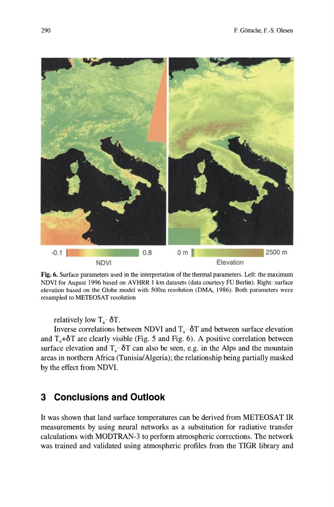
Fig. 6. Surface parameters used in the interpretation ofthe thermal parameters. Left: the maximum
NDVI for August 1996 based on AVHRR 1 km datasets (data courtesy FU Berlin). Right: surface
elevation based on the Globe model with 500m resolution (DMA, 1986). Both parameters were
resampled to METEOSAT resolution
relatively low Ta - oT.
Inverse correlations between NDVI and Ta - oT and between surface elevation
and To+OT are clearly visible (Fig. 5 and Fig. 6). A positive correlation between
surface elevation and Ta - oT can also be seen, e.g. in the Alps and the mountain
areas in northern Africa (Tunisia/Algeria); the relationship being partially masked
by the effect from NDVI.
3 Conclusions and Outlook
It was shown that land surface temperatures can be derived from METEOSAT IR
measurements by using neural networks as a substitution for radiative transfer
calculations with MODTRAN-3 to perform atmospheric corrections. The network
was trained and validated using atmospheric profiles from the TIOR library and
F. Gottsche. F.-S. Olesen
NDVI
Elevation
Fig. 6. Surface parameters used in the interpretation ofthe thermal parameters. Left: the maximum
NDVI for August 1996 based on AVHRR 1 km datasets (data courtesy FU Berlin). Right: surface
elevation based on the Globe model with 500m resolution (DMA, 1986). Both parameters were
resampled to METEOSAT resolution
relatively low Ta - oT.
Inverse correlations between NDVI and Ta - oT and between surface elevation
and To+OT are clearly visible (Fig. 5 and Fig. 6). A positive correlation between
surface elevation and Ta - oT can also be seen, e.g. in the Alps and the mountain
areas in northern Africa (Tunisia/Algeria); the relationship being partially masked
by the effect from NDVI.
3 Conclusions and Outlook
It was shown that land surface temperatures can be derived from METEOSAT IR
measurements by using neural networks as a substitution for radiative transfer
calculations with MODTRAN-3 to perform atmospheric corrections. The network
was trained and validated using atmospheric profiles from the TIOR library and