

Indicators and Information Requirements for Combatting Desertification
103
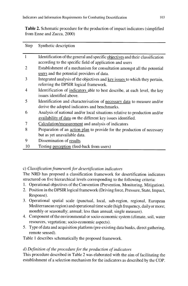
Table 2. Schematic procedure for the production of impact indicators (simplified
from Enne and Zucca, 2000)
Step Synthetic description
Identification of the general and specific objectives and their classification
according to the specific field of application and users
2
Establishment of a mechanism for consultation amongst all the potential
users and the potential providers of data.
3
Integrated analysis of the objectives and key issues to which they pertain,
referring the DPSIR logical framework.
4
Identification of indicators able to best describe, at each level, the key
issues identified above.
5
Identification and characterisation of necessary data to measure and/or
derive the adopted indicators and benchmarks.
6
Analysis of national and/or local situations relative to production and/or
availability of data on the different key issues identified.
7
Calculation/measurement and analysis of indicators
8
Preparation of an action plan to provide for the production of necessary
but as yet unavailable data.
9
Dissemination of results
10
Testing perception (feed-back from users)
c) Classification framework for desertification indicators
The NRD has proposed a classification framework for desertification indicators
structured on five hierarchical levels corresponding to the following criteria:
1. Operational objectives of the Convention (Prevention, Monitoring, Mitigation).
2. Position in the DPSIR logical framework (Driving force, Pressure, State, Impact,
Response).
3. Operational spatial scale (punctual, local, sub-region, regional, European
Mediterranean region) and operational time scale (high frequency, daily or more;
monthly or seasonally; annual; less than annual; single measure).
4. Component of the environmental or socio-economic system (climate, soil, water
resources, vegetation; socio-economic aspects).
5. Type of data and acquisition platform (pre-existing data banks, direct gathering,
remote sensed).
Table 1 describes schematically the proposed framework.
d) Definition of the procedure for the production of indicators
This procedure described in Table 2 was elaborated with the aim of facilitating the
establishment of a selection mechanism for the indicators as described by the COP.
103
Table 2. Schematic procedure for the production of impact indicators (simplified
from Enne and Zucca, 2000)
Step Synthetic description
Identification of the general and specific objectives and their classification
according to the specific field of application and users
2
Establishment of a mechanism for consultation amongst all the potential
users and the potential providers of data.
3
Integrated analysis of the objectives and key issues to which they pertain,
referring the DPSIR logical framework.
4
Identification of indicators able to best describe, at each level, the key
issues identified above.
5
Identification and characterisation of necessary data to measure and/or
derive the adopted indicators and benchmarks.
6
Analysis of national and/or local situations relative to production and/or
availability of data on the different key issues identified.
7
Calculation/measurement and analysis of indicators
8
Preparation of an action plan to provide for the production of necessary
but as yet unavailable data.
9
Dissemination of results
10
Testing perception (feed-back from users)
c) Classification framework for desertification indicators
The NRD has proposed a classification framework for desertification indicators
structured on five hierarchical levels corresponding to the following criteria:
1. Operational objectives of the Convention (Prevention, Monitoring, Mitigation).
2. Position in the DPSIR logical framework (Driving force, Pressure, State, Impact,
Response).
3. Operational spatial scale (punctual, local, sub-region, regional, European
Mediterranean region) and operational time scale (high frequency, daily or more;
monthly or seasonally; annual; less than annual; single measure).
4. Component of the environmental or socio-economic system (climate, soil, water
resources, vegetation; socio-economic aspects).
5. Type of data and acquisition platform (pre-existing data banks, direct gathering,
remote sensed).
Table 1 describes schematically the proposed framework.
d) Definition of the procedure for the production of indicators
This procedure described in Table 2 was elaborated with the aim of facilitating the
establishment of a selection mechanism for the indicators as described by the COP.