

36
2 Geomatics standards
d
-- ....
p
.. '
[i
- . . . . . . _ - ----------- -- ~--,#'
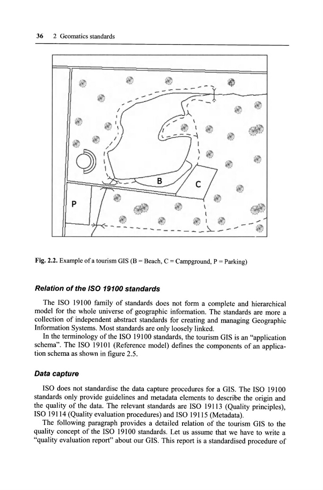
Fig. 2.2. Example of a tourism GIS (B = Beach, C = Campground, P = Parking)
Relation of the ISO 19100 standards
The ISO 19100 family of standards does not form a eomplete and hierarehieal
model for the whole uni verse of geographie information. The standards are more a
eolleetion of independent abstract standards for ereating and managing Geographie
Information Systems. Most standards are only loosely linked.
In the terminology of the ISO 19100 standards, the tourism GIS is an "applieation
schema". The ISO 19101 (Referenee model) defines the components of an application schema as shown in figure 2.5 .
Data capture
ISO does not standardise the data capture proeedures for a GIS. The ISO 19100
standards only provide guidelines and metadata elements to deseribe the origin and
the quality of the data. The relevant standards are ISO 19113 (Quality prineiples),
ISO 19114 (Quality evaluation proeedures) and ISO 19115 (Metadata).
The following paragraph provides a detailed relation of the tourism GIS to the
quality eoneept of the ISO 19100 standards. Let us assume that we have to write a
"quality evaluation report" about our GIS. This report is a standardised proeedure of
2 Geomatics standards
d
-- ....
p
.. '
[i
- . . . . . . _ - ----------- -- ~--,#'
Fig. 2.2. Example of a tourism GIS (B = Beach, C = Campground, P = Parking)
Relation of the ISO 19100 standards
The ISO 19100 family of standards does not form a eomplete and hierarehieal
model for the whole uni verse of geographie information. The standards are more a
eolleetion of independent abstract standards for ereating and managing Geographie
Information Systems. Most standards are only loosely linked.
In the terminology of the ISO 19100 standards, the tourism GIS is an "applieation
schema". The ISO 19101 (Referenee model) defines the components of an application schema as shown in figure 2.5 .
Data capture
ISO does not standardise the data capture proeedures for a GIS. The ISO 19100
standards only provide guidelines and metadata elements to deseribe the origin and
the quality of the data. The relevant standards are ISO 19113 (Quality prineiples),
ISO 19114 (Quality evaluation proeedures) and ISO 19115 (Metadata).
The following paragraph provides a detailed relation of the tourism GIS to the
quality eoneept of the ISO 19100 standards. Let us assume that we have to write a
"quality evaluation report" about our GIS. This report is a standardised proeedure of