

208
5 Liaison members ofISO/TC211
number of formalized document types. OGC has adopted the ISO template for the
purpose of publishing a printed standard.
The document types are called Request for Proposal (RFP), Request for Information (RFI), Request for Comment (RFC), and Request for Technology (RFT).
An RFP is issued to the public by the OGC after a piece of the Open GIS Specification has been agreed upon. RFP submissions offered by members are demonstrably workable Implementation Specifications. An RFI is issued to the public by the
OGC at critical points to ensure that all industry players have an opportunity to give
the OGC their wisdom during the development of a specification. An RFC describes
interface technology offered by a member or team of members who wants the consortium to adopt their technology rather than develop similar technology through the
usual Technical Committee process. An RFT is issued to the public at the beginning
of an Interoperability Initiative to stimulate submissions of interface technologies
that need to be evaluated and modified in a testbed (OGC 2003).
The committees involved in the OGC's standardisation process are structured in
three levels. The strategie decisions are made in the Management Committee (MC).
The technical work is coordinated in the Technical Committee (TC). The Working
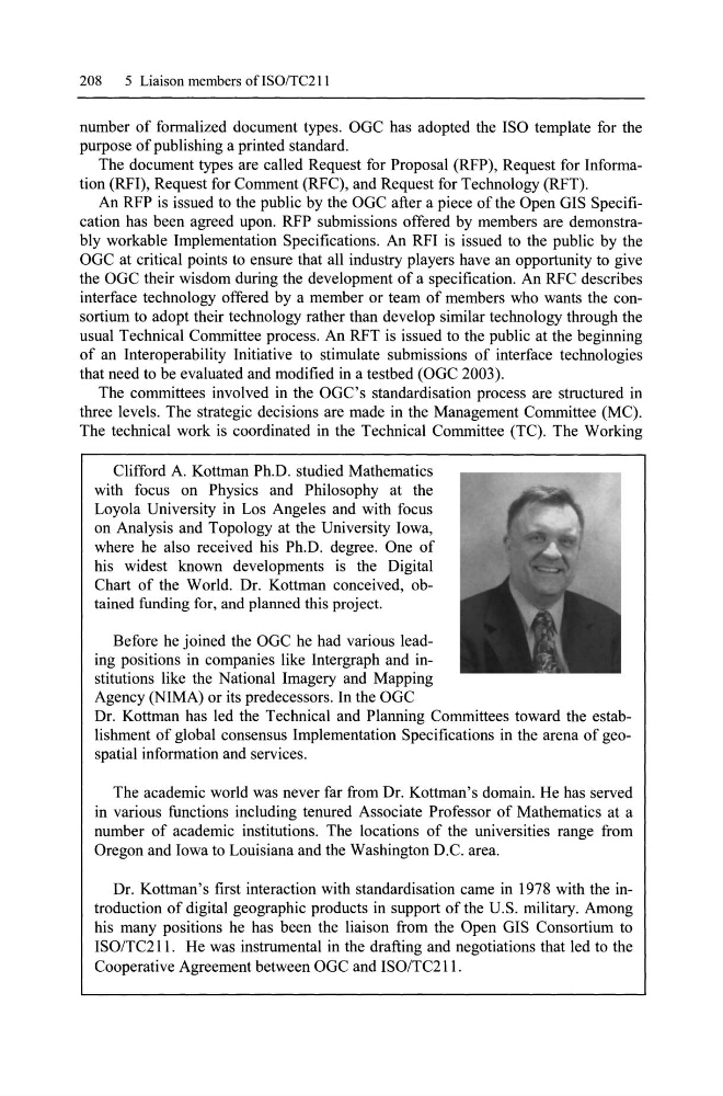
Clifford A. Kottman Ph.D. studied Mathematics
with focus on Physics and Philosophy at the
Loyola University in Los Angeles and with focus
on Analysis and Topology at the University lowa,
where he also received his Ph.D. degree. One of
his widest known developments is the Digital
Chart of the World. Dr. Kottman conceived, obtained funding for, and planned this project.
Before he joined the OGC he had various leading positions in companies like Intergraph and institutions like the National Imagery and Mapping
Agency (NIMA) or its predecessors. In the OGC
Dr. Kottman has led the Technical and Planning Committees toward the establishment of global consensus Implementation Specifications in the arena of geospatial information and services.
The academic world was never far from Dr. Kottman's domain. He has served
in various functions inc\uding tenured Associate Professor of Mathematics at a
number of academic institutions. The locations of the universities range from
Oregon and lowa to Louisiana and the Washington D.C. area.
Dr. Kottman's first interaction with standardisation came in 1978 with the introduction of digital geographie products in support of the U.S. military. Among
his many positions he has been the liaison from the Open GIS Consortium to
ISO/TC2!!. He was instrumental in the drafting and negotiations that led to the
Cooperative Agreement between OGC and ISO/TC2!! .
5 Liaison members ofISO/TC211
number of formalized document types. OGC has adopted the ISO template for the
purpose of publishing a printed standard.
The document types are called Request for Proposal (RFP), Request for Information (RFI), Request for Comment (RFC), and Request for Technology (RFT).
An RFP is issued to the public by the OGC after a piece of the Open GIS Specification has been agreed upon. RFP submissions offered by members are demonstrably workable Implementation Specifications. An RFI is issued to the public by the
OGC at critical points to ensure that all industry players have an opportunity to give
the OGC their wisdom during the development of a specification. An RFC describes
interface technology offered by a member or team of members who wants the consortium to adopt their technology rather than develop similar technology through the
usual Technical Committee process. An RFT is issued to the public at the beginning
of an Interoperability Initiative to stimulate submissions of interface technologies
that need to be evaluated and modified in a testbed (OGC 2003).
The committees involved in the OGC's standardisation process are structured in
three levels. The strategie decisions are made in the Management Committee (MC).
The technical work is coordinated in the Technical Committee (TC). The Working
Clifford A. Kottman Ph.D. studied Mathematics
with focus on Physics and Philosophy at the
Loyola University in Los Angeles and with focus
on Analysis and Topology at the University lowa,
where he also received his Ph.D. degree. One of
his widest known developments is the Digital
Chart of the World. Dr. Kottman conceived, obtained funding for, and planned this project.
Before he joined the OGC he had various leading positions in companies like Intergraph and institutions like the National Imagery and Mapping
Agency (NIMA) or its predecessors. In the OGC
Dr. Kottman has led the Technical and Planning Committees toward the establishment of global consensus Implementation Specifications in the arena of geospatial information and services.
The academic world was never far from Dr. Kottman's domain. He has served
in various functions inc\uding tenured Associate Professor of Mathematics at a
number of academic institutions. The locations of the universities range from
Oregon and lowa to Louisiana and the Washington D.C. area.
Dr. Kottman's first interaction with standardisation came in 1978 with the introduction of digital geographie products in support of the U.S. military. Among
his many positions he has been the liaison from the Open GIS Consortium to
ISO/TC2!!. He was instrumental in the drafting and negotiations that led to the
Cooperative Agreement between OGC and ISO/TC2!! .