

108
3 Non-geometry standards
SI
S2
S3
q = LLL bklmxnk Yn
l Zn m
k=O 1=0 m=O
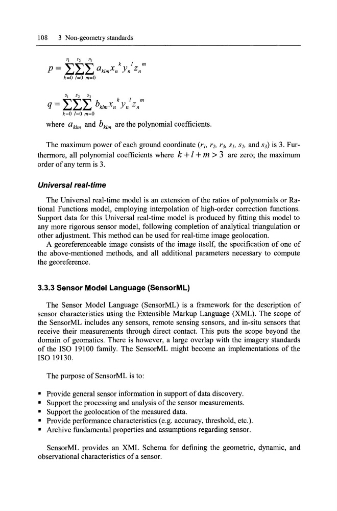
where aklm and b k1m are the polynomial coefficients.
The maximum power of each ground coordinate (r], r2, r3, S], S2, and S3) is 3. Furthermore, all polynomial coefficients where k + I + m > 3 are zero; the maximum
order of any term is 3.
Universal real-time
The Universal real-time model is an extension of the ratios of polynomials or Rational Functions model, employing interpolation of high-order correction functions.
Support data for this Universal real-time model is produced by fitting this model to
any more rigorous sensor model, following completion of analytical triangulation or
other adjustment. This method can be used for real-time image geolocation.
A georeferenceable image consists of the image itself, the specification of one of
the above-mentioned methods, and all additional parameters necessary to compute
the georeference.
3.3.3 Sensor Model Language (SensorML)
The Sensor Model Language (SensorML) is a framework for the description of
sensor characteristics using the Extensible Markup Language (XML). The scope of
the SensorML includes any sensors, remote sensing sensors, and in-situ sensors that
receive their measurements through direct contact. This puts the scope beyond the
domain of geomatics. There is however, a large overlap with the imagery standards
of the ISO 19100 family. The SensorML might become an implementations of the
ISO 19130.
The purpose of SensorML is to:
• Provide general sensor information in support of data discovery.
• Support the processing and analysis of the sensor measurements.
• Support the geolocation ofthe measured data.
• Provide performance characteristics (e.g. accuracy, threshold, etc.).
• Archive fundamental properties and assumptions regarding sensor.
SensorML provides an XML Schema for defining the geometrie, dynamic, and
observational characteristics of a sensor.
3 Non-geometry standards
SI
S2
S3
q = LLL bklmxnk Yn
l Zn m
k=O 1=0 m=O
where aklm and b k1m are the polynomial coefficients.
The maximum power of each ground coordinate (r], r2, r3, S], S2, and S3) is 3. Furthermore, all polynomial coefficients where k + I + m > 3 are zero; the maximum
order of any term is 3.
Universal real-time
The Universal real-time model is an extension of the ratios of polynomials or Rational Functions model, employing interpolation of high-order correction functions.
Support data for this Universal real-time model is produced by fitting this model to
any more rigorous sensor model, following completion of analytical triangulation or
other adjustment. This method can be used for real-time image geolocation.
A georeferenceable image consists of the image itself, the specification of one of
the above-mentioned methods, and all additional parameters necessary to compute
the georeference.
3.3.3 Sensor Model Language (SensorML)
The Sensor Model Language (SensorML) is a framework for the description of
sensor characteristics using the Extensible Markup Language (XML). The scope of
the SensorML includes any sensors, remote sensing sensors, and in-situ sensors that
receive their measurements through direct contact. This puts the scope beyond the
domain of geomatics. There is however, a large overlap with the imagery standards
of the ISO 19100 family. The SensorML might become an implementations of the
ISO 19130.
The purpose of SensorML is to:
• Provide general sensor information in support of data discovery.
• Support the processing and analysis of the sensor measurements.
• Support the geolocation ofthe measured data.
• Provide performance characteristics (e.g. accuracy, threshold, etc.).
• Archive fundamental properties and assumptions regarding sensor.
SensorML provides an XML Schema for defining the geometrie, dynamic, and
observational characteristics of a sensor.