

3.3 Imagery standards
107
point coordinates and the related two sensor data coordinates. The ISO 19130 does
not define the interpolation method to be used between the grid points.
Polynomials
The polynomials method presents the sensor data coordinate (row or track i and
column or cross-trackj) as a function of ground point coordinates (x, y, and optional
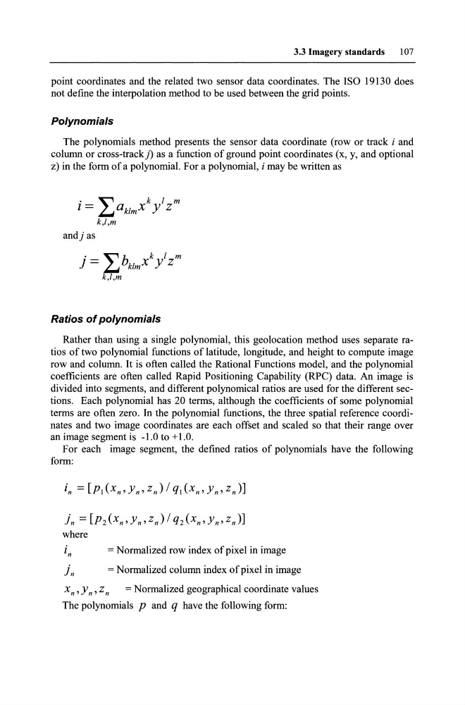
z) in the form of a polynomial. For a polynomial, i may be written as
•
~
k 1 m
1 = ~aklmX Y Z
k,l,m
andj as
j = L bklmx k / Zm
k,l,m
Ratios of polynomials
Rather than using a single polynomial, this geolocation method uses separate ratios of two polynomial functions of latitude, longitude, and height to compute image
row and column. It is often called the Rational Functions model, and the polynomial
coefficients are often called Rapid Positioning Capability (RPC) data. An image is
divided into segments, and different polynomical ratios are used for the different sections. Each polynomial has 20 terms, although the coefficients of some polynomial
terms are often zero. In the polynomial functions, the three spatial reference coordinates and two image coordinates are each off set and scaled so that their range over
an image segment is -1.0 to + 1.0.
For each image segment, the defined ratios of polynomials have the following
form:
jn = [p2(x n ,y n ,zJI Q2(X n ,Yn,zn)]
where
in
= Normalized row index ofpixel in image
j n
= Normalized column index ofpixel in image
x n ,y n ,zn = Normalized geographical coordinate values
The polynomials P and q have the following form:
107
point coordinates and the related two sensor data coordinates. The ISO 19130 does
not define the interpolation method to be used between the grid points.
Polynomials
The polynomials method presents the sensor data coordinate (row or track i and
column or cross-trackj) as a function of ground point coordinates (x, y, and optional
z) in the form of a polynomial. For a polynomial, i may be written as
•
~
k 1 m
1 = ~aklmX Y Z
k,l,m
andj as
j = L bklmx k / Zm
k,l,m
Ratios of polynomials
Rather than using a single polynomial, this geolocation method uses separate ratios of two polynomial functions of latitude, longitude, and height to compute image
row and column. It is often called the Rational Functions model, and the polynomial
coefficients are often called Rapid Positioning Capability (RPC) data. An image is
divided into segments, and different polynomical ratios are used for the different sections. Each polynomial has 20 terms, although the coefficients of some polynomial
terms are often zero. In the polynomial functions, the three spatial reference coordinates and two image coordinates are each off set and scaled so that their range over
an image segment is -1.0 to + 1.0.
For each image segment, the defined ratios of polynomials have the following
form:
jn = [p2(x n ,y n ,zJI Q2(X n ,Yn,zn)]
where
in
= Normalized row index ofpixel in image
j n
= Normalized column index ofpixel in image
x n ,y n ,zn = Normalized geographical coordinate values
The polynomials P and q have the following form: