

408
J. Raper et al.
Where there are ‘negative depths’ on the chart i.e. height values on drying intertidal
bars which are above LAT these values are subtracted from the tidal range to give a
‘negative depth below the terrestrial datum’ which is then smaller than the tidal range.
THE REGIONALISATION OF DATA COLLECTED AT POINTS
Many coastal datasets are collected at points but need to be regionalised i.e. the values
interpolated between data points, and sometimes, extrapolated into areas with no data.
However, the regionalisation needs to be appropriate to the phenomenon being
observed, for example, depending on whether the data is discrete or continuous. The
available procedures range from interpolation for continuous data to region building
techniques (for example, Thiessen polygon creation) that can be used to create discrete
zones with sharp boundaries.
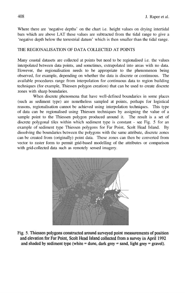
When discrete phenomena that have well-defined boundaries in some places
(such as sediment type) are nonetheless sampled at points, perhaps for logistical
reasons, regionalisation cannot be achieved using interpolation techniques. This type
of data can be regionalised using Thiessen techniques by assigning the value of a
sample point to the Thiessen polygon produced around it. The result is a set of
discrete polygonal tiles within which sediment type is constant - see Fig. 5 for an
example of sediment type Thiessen polygons for Far Point, Scolt Head Island. By
dissolving the boundaries between the polygons with the same attribute, discrete zones
can be created from (originally) point data. These zones can then be converted from
vector to raster form to permit grid-based modelling of the attributes or comparison
with grid-collected data such as remotely sensed imagery.
J. Raper et al.
Where there are ‘negative depths’ on the chart i.e. height values on drying intertidal
bars which are above LAT these values are subtracted from the tidal range to give a
‘negative depth below the terrestrial datum’ which is then smaller than the tidal range.
THE REGIONALISATION OF DATA COLLECTED AT POINTS
Many coastal datasets are collected at points but need to be regionalised i.e. the values
interpolated between data points, and sometimes, extrapolated into areas with no data.
However, the regionalisation needs to be appropriate to the phenomenon being
observed, for example, depending on whether the data is discrete or continuous. The
available procedures range from interpolation for continuous data to region building
techniques (for example, Thiessen polygon creation) that can be used to create discrete
zones with sharp boundaries.
When discrete phenomena that have well-defined boundaries in some places
(such as sediment type) are nonetheless sampled at points, perhaps for logistical
reasons, regionalisation cannot be achieved using interpolation techniques. This type
of data can be regionalised using Thiessen techniques by assigning the value of a
sample point to the Thiessen polygon produced around it. The result is a set of
discrete polygonal tiles within which sediment type is constant - see Fig. 5 for an
example of sediment type Thiessen polygons for Far Point, Scolt Head Island. By
dissolving the boundaries between the polygons with the same attribute, discrete zones
can be created from (originally) point data. These zones can then be converted from
vector to raster form to permit grid-based modelling of the attributes or comparison
with grid-collected data such as remotely sensed imagery.