

Melanesia
327
the Sepik and Ramu river mouths fringing reefs continue,
often in long unbroken stretches up to the easternmost point
of East Cape, while in places barrier reefs run further
offshore, notably around Madang where there are about 50
associated offshore islands. It has been estimated that, in
all. over half of this coastline may have fringing reefs. There
is a major break in the fringing reef around Lae in the Huon
Gulf, where the Markham River delivers an estimated 10
million tons of sediment per year. Along the southern coast,
reef development is somewhat restricted in the area of the
Fly River Delta and the smaller river deltas to the east,
where there are extensive mangrove forests, turbidity is
high and salinities are variable. Further east, coral reefs are
widespread from Port Moresby eastwards. These are
sometimes termed the Papuan Barrier Reef as they run
some distance offshore, separated by a lagoon about 5
kilometers wide. The total length of this reef is some 560
kilometers, though this is broken by a number of channels.
Northern islands and reefs
To the north of the mainland, the westernmost islands of
the Bismarck chain include a number of coralline islands
surrounded by fringing reefs, and also a number of atolls,
including the large Ninigo Atoll, Liot, Heina and Kaniet
(Sae) Islands. The Hermit group is a near-atoll, with two
high basaltic islands in the center of its lagoon. East of
these lie the Admiralty Islands, dominated by the volcanic
Manus Island, but including a number of smaller islands
and atoll formations. The large volcanic islands of
Lavongai (New Hanover) and New Ireland lie further east,
with other smaller high ones to the north, including the
St. Matthias group, Tabar and Lihir Islands. Reefs are
widespread and include fringing systems as well as
platform and atoll structures, though few details are
available about these. Equally little is known about the
reefs of Bougainville Island; a barrier reef is located about
15 kilometers off the southwest coast and there are other
barrier structures with a number of small associated islets
off the east coast. Around New Britain the shelf is mostly
very narrow and, although there are fringing reefs, they
are not continuous. There are also various offshore patch
and barrier structures, including around Kimbe Bay and
the Gazelle Peninsula in the north.
Southeast
Perhaps the most extensive reef systems in the country
are those of Milne Bay Province. The continental shelf
is broad and scattered with numerous platform reefs,
some with their associated islands (both volcanic and
calcareous) between the mainland and the Trobriand Islands
to the north. These islands are relatively flat limestone
structures. The same shelf continues southwards to the
volcanic D'Entrecasteaux Islands. East of theTrobriands are
several islands and reefs, including Egum Atoll, the large
Muyua (Woodlark) Island with associated fringe and nearbarrier reef systems, and Budibudi Atoll in the far east. A
long chain of reefs and islands extends southwest from the
tip of Papua New Guinea and here there is a vast complex of
reefs. The most significant is the Calvados Barrier Reef,
extending as a long arm along the southern edge of the
continental shelf, right around the tip of Sudest Island to
follow the northern edge of the shelf, a total distance of
some 640 kilometers. This system encircles many other
lagoonal platform reefs and fringing reefs around islands.
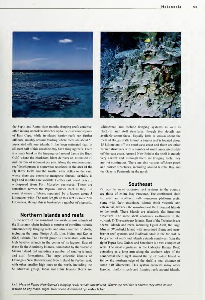
Left: Many of Papua New Guinea s fringing reefs remain unexplored. Wfiere the reef flat is narrow tfiey often do not
feature on any maps. Right: Reef scene dominated by Porites lichen.
327
the Sepik and Ramu river mouths fringing reefs continue,
often in long unbroken stretches up to the easternmost point
of East Cape, while in places barrier reefs run further
offshore, notably around Madang where there are about 50
associated offshore islands. It has been estimated that, in
all. over half of this coastline may have fringing reefs. There
is a major break in the fringing reef around Lae in the Huon
Gulf, where the Markham River delivers an estimated 10
million tons of sediment per year. Along the southern coast,
reef development is somewhat restricted in the area of the
Fly River Delta and the smaller river deltas to the east,
where there are extensive mangrove forests, turbidity is
high and salinities are variable. Further east, coral reefs are
widespread from Port Moresby eastwards. These are
sometimes termed the Papuan Barrier Reef as they run
some distance offshore, separated by a lagoon about 5
kilometers wide. The total length of this reef is some 560
kilometers, though this is broken by a number of channels.
Northern islands and reefs
To the north of the mainland, the westernmost islands of
the Bismarck chain include a number of coralline islands
surrounded by fringing reefs, and also a number of atolls,
including the large Ninigo Atoll, Liot, Heina and Kaniet
(Sae) Islands. The Hermit group is a near-atoll, with two
high basaltic islands in the center of its lagoon. East of
these lie the Admiralty Islands, dominated by the volcanic
Manus Island, but including a number of smaller islands
and atoll formations. The large volcanic islands of
Lavongai (New Hanover) and New Ireland lie further east,
with other smaller high ones to the north, including the
St. Matthias group, Tabar and Lihir Islands. Reefs are
widespread and include fringing systems as well as
platform and atoll structures, though few details are
available about these. Equally little is known about the
reefs of Bougainville Island; a barrier reef is located about
15 kilometers off the southwest coast and there are other
barrier structures with a number of small associated islets
off the east coast. Around New Britain the shelf is mostly
very narrow and, although there are fringing reefs, they
are not continuous. There are also various offshore patch
and barrier structures, including around Kimbe Bay and
the Gazelle Peninsula in the north.
Southeast
Perhaps the most extensive reef systems in the country
are those of Milne Bay Province. The continental shelf
is broad and scattered with numerous platform reefs,
some with their associated islands (both volcanic and
calcareous) between the mainland and the Trobriand Islands
to the north. These islands are relatively flat limestone
structures. The same shelf continues southwards to the
volcanic D'Entrecasteaux Islands. East of theTrobriands are
several islands and reefs, including Egum Atoll, the large
Muyua (Woodlark) Island with associated fringe and nearbarrier reef systems, and Budibudi Atoll in the far east. A
long chain of reefs and islands extends southwest from the
tip of Papua New Guinea and here there is a vast complex of
reefs. The most significant is the Calvados Barrier Reef,
extending as a long arm along the southern edge of the
continental shelf, right around the tip of Sudest Island to
follow the northern edge of the shelf, a total distance of
some 640 kilometers. This system encircles many other
lagoonal platform reefs and fringing reefs around islands.
Left: Many of Papua New Guinea s fringing reefs remain unexplored. Wfiere the reef flat is narrow tfiey often do not
feature on any maps. Right: Reef scene dominated by Porites lichen.