

Middle Eastern Seas
251
Arabian Gulf:
United Arab Emirates, Qatar,
Bahrain, Kuwait, Iran
MAP9e
The
Arabian Gulf is a vast shallow marine basin
which has formed on the northeastern and eastern
edge of the Arabian tectonic plate. Unlike the Red
Sea, it receives considerable riverine input at its northern
end from the Shatt al Arab waterway which is formed from
the Tigris, Euphrates and Karun Rivers. In addition there
are a number of rivers flowing from the Zagros Mountains
in Iran. On average the Gulf is only around 35 meters
deep, and at its deepest point in the southeast it only
reaches about 100 meters. During the last glacial maxima
this entire area dried up and all marine life was
extinguished. The large rivers at this time would have
continued to flow along the eastern edge of the area and
out through the Straits of Hormuz. Climatically this is an
extremely harsh region. Most of the Gulf is sub-tropical,
and the surrounding arid land masses drive extremes of
temperatures, with air temperatures frequently reaching
50°C in the summer, but falling to 0°C in the winter. The
shallow water does little to ameliorate these fluctuations
and most nearshore waters range between 10 and 39°C
through the year. Winds further influence temperatures
quite considerably, and can also deliver large quantities
of sediment. Despite the high riverine input this is a
very saline basin - riverine input plus rainfall contribute
the equivalent of 15-50 centimeters of water depth per
year, but levels of evaporation range from 140 to 500
centimeters so that salinities are typically 40%o, but often
reach 70%o or more in enclosed embayments. The general pattern of current circulation is one of a counterclockwise flow. Lighter, less saline, waters enter from the
Gulf of Oman and flow north along the coast of Iran, then
down the eastern shores of the Arabian Peninsula. As evaporation increases the salinity and density of the water, so
it sinks, and there is actually an outflow at deeper levels
of more saline water through the Straits of Hormuz not
unlike that occurring in the Red Sea. Circulation is greatly
restricted in the embayments of the Gulf of Salwah and
the shallow waters off the United Arab Emirates, driving
massive evaporation and even more extreme environmental conditions.
The benthic surfaces of most of the Gulf are
featureless soft sediments, dominated by muds in the
north and east and carbonate sands in the south and
west. There are several areas of rocky shore, both on the
mainland and offshore islands. Fringing and patch reefs
have developed in a number of places. In many areas the
division between true reefs and carbonate structures with
little active coral growth is blurred and there are quite a
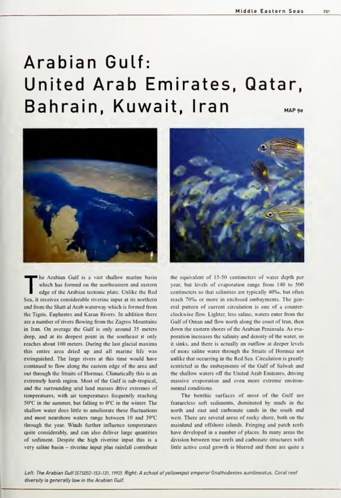
Left: The Arabian GulflSTS052-153-13l 19921. Right: A school of yellowspot emperor Gnathodentex aurolineatus. Coral reef
diversity is generally low in the Arabian Gulf
251
Arabian Gulf:
United Arab Emirates, Qatar,
Bahrain, Kuwait, Iran
MAP9e
The
Arabian Gulf is a vast shallow marine basin
which has formed on the northeastern and eastern
edge of the Arabian tectonic plate. Unlike the Red
Sea, it receives considerable riverine input at its northern
end from the Shatt al Arab waterway which is formed from
the Tigris, Euphrates and Karun Rivers. In addition there
are a number of rivers flowing from the Zagros Mountains
in Iran. On average the Gulf is only around 35 meters
deep, and at its deepest point in the southeast it only
reaches about 100 meters. During the last glacial maxima
this entire area dried up and all marine life was
extinguished. The large rivers at this time would have
continued to flow along the eastern edge of the area and
out through the Straits of Hormuz. Climatically this is an
extremely harsh region. Most of the Gulf is sub-tropical,
and the surrounding arid land masses drive extremes of
temperatures, with air temperatures frequently reaching
50°C in the summer, but falling to 0°C in the winter. The
shallow water does little to ameliorate these fluctuations
and most nearshore waters range between 10 and 39°C
through the year. Winds further influence temperatures
quite considerably, and can also deliver large quantities
of sediment. Despite the high riverine input this is a
very saline basin - riverine input plus rainfall contribute
the equivalent of 15-50 centimeters of water depth per
year, but levels of evaporation range from 140 to 500
centimeters so that salinities are typically 40%o, but often
reach 70%o or more in enclosed embayments. The general pattern of current circulation is one of a counterclockwise flow. Lighter, less saline, waters enter from the
Gulf of Oman and flow north along the coast of Iran, then
down the eastern shores of the Arabian Peninsula. As evaporation increases the salinity and density of the water, so
it sinks, and there is actually an outflow at deeper levels
of more saline water through the Straits of Hormuz not
unlike that occurring in the Red Sea. Circulation is greatly
restricted in the embayments of the Gulf of Salwah and
the shallow waters off the United Arab Emirates, driving
massive evaporation and even more extreme environmental conditions.
The benthic surfaces of most of the Gulf are
featureless soft sediments, dominated by muds in the
north and east and carbonate sands in the south and
west. There are several areas of rocky shore, both on the
mainland and offshore islands. Fringing and patch reefs
have developed in a number of places. In many areas the
division between true reefs and carbonate structures with
little active coral growth is blurred and there are quite a
Left: The Arabian GulflSTS052-153-13l 19921. Right: A school of yellowspot emperor Gnathodentex aurolineatus. Coral reef
diversity is generally low in the Arabian Gulf