

Western Indian Ocean
183
Kenya and
southern Somalia
MAP 7a
K6ny3
has a relatively narrow coastal plain to
the south, with a series of raised Pleistocene reef
platforms above the present day intertidal platform.
North of Malindi the coastal plain becomes much broader
and is dominated by older sedimentary plains. There is a
relatively narrow continental shelf, only extending about
5 kilometers offshore south of Malindi, broadening to 60
kilometers offshore in the north. There are two major
permanent rivers, the Athi-Galana-Sabaki which reaches
the coast in an estuary just north of Malindi, and the Tana
which lies further north again and reaches the coast in
a large delta with associated swamps, mangrove communities and shifting dunes. There are several nearshore
islands, notably those of the Lamu Archipelago in the
mouth of Lamu and Manda Bays, but also a chain of about
50 calcareous barrier islands further north around Kiunga.
Patterns of coastal currents are largely driven by the
major oceanographic currents. South of Malindi, the East
African Coastal Current flows northeast throughout the
year coming up from Tanzania and originally driven by
the South Equatorial Current. North of Malindi this same
East African Coastal Current continues to flow for part of
the year during the Southeast Monsoon (April-October).
During the Northeast Monsoon (December-March),
however, it is reversed, countered by the southward
flowing Somali Current. Around Malindi the two currents
meet and flow out to sea, forming the North Equatorial
Counter Current.
Fringing reefs are well developed in southern Kenya.
However, to the north, where there are large areas of loose
sediment and significant freshwater influences, levels of
development are lower. There are fringing reefs in places
off the Lamu islands, and also along many of the barrier
islands further north.
Patterns of biodiversity appear to follow patterns of
reef development, with generally higher diversity in the
south. Active coral growth is not continuous along the
fringing reefs, but is interspersed with extensive seagrass
and algal beds. Where hard substrates occur, live coral
cover was typically about 30 percent prior to 1998. Some
55 coral genera and up to 200 species have been recorded
in Kenya. Mangroves are widespread in creeks and inlets
as well as the larger estuaries. Important mangrove
communities are also found on the leeward shores of
offshore islands and on their corresponding mainland
coasts. There are very important nesting communities of
terns and gulls on a number of offshore islands, notably
the barrier islands in Kiunga. Much of the Kenyan
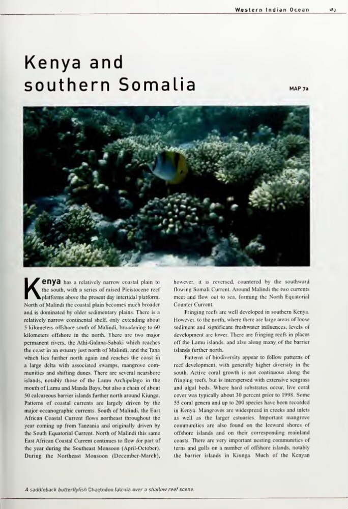
A saddleback butterflyfish Chaetodon falcula over a shallow reef scene.
183
Kenya and
southern Somalia
MAP 7a
K6ny3
has a relatively narrow coastal plain to
the south, with a series of raised Pleistocene reef
platforms above the present day intertidal platform.
North of Malindi the coastal plain becomes much broader
and is dominated by older sedimentary plains. There is a
relatively narrow continental shelf, only extending about
5 kilometers offshore south of Malindi, broadening to 60
kilometers offshore in the north. There are two major
permanent rivers, the Athi-Galana-Sabaki which reaches
the coast in an estuary just north of Malindi, and the Tana
which lies further north again and reaches the coast in
a large delta with associated swamps, mangrove communities and shifting dunes. There are several nearshore
islands, notably those of the Lamu Archipelago in the
mouth of Lamu and Manda Bays, but also a chain of about
50 calcareous barrier islands further north around Kiunga.
Patterns of coastal currents are largely driven by the
major oceanographic currents. South of Malindi, the East
African Coastal Current flows northeast throughout the
year coming up from Tanzania and originally driven by
the South Equatorial Current. North of Malindi this same
East African Coastal Current continues to flow for part of
the year during the Southeast Monsoon (April-October).
During the Northeast Monsoon (December-March),
however, it is reversed, countered by the southward
flowing Somali Current. Around Malindi the two currents
meet and flow out to sea, forming the North Equatorial
Counter Current.
Fringing reefs are well developed in southern Kenya.
However, to the north, where there are large areas of loose
sediment and significant freshwater influences, levels of
development are lower. There are fringing reefs in places
off the Lamu islands, and also along many of the barrier
islands further north.
Patterns of biodiversity appear to follow patterns of
reef development, with generally higher diversity in the
south. Active coral growth is not continuous along the
fringing reefs, but is interspersed with extensive seagrass
and algal beds. Where hard substrates occur, live coral
cover was typically about 30 percent prior to 1998. Some
55 coral genera and up to 200 species have been recorded
in Kenya. Mangroves are widespread in creeks and inlets
as well as the larger estuaries. Important mangrove
communities are also found on the leeward shores of
offshore islands and on their corresponding mainland
coasts. There are very important nesting communities of
terns and gulls on a number of offshore islands, notably
the barrier islands in Kiunga. Much of the Kenyan
A saddleback butterflyfish Chaetodon falcula over a shallow reef scene.