

170
WORLD ATLAS OF CORAL REEFS
which lie in a chain parallel to the coast. These reefs have
a high species diversity, including some 270 species of
coral reef fish. Los Roques is an archipelago of 40 small
islands, including one rocky island and 39 coral cays in an
atoll-like formation. The continental shelf is narrow to the
south but nearly 1 kilometer wide to the north. Coral cover
remains high at this site, averaging 27 percent in 1999/
2000, but reaching 60 percent in some localities. A total
of 5 1 hermatypic coral species have been recorded. The
whole archipelago was declared a Venezuelan national
park in 1972 and is one of the largest marine national
parks in the Caribbean.
Water moves through these offshore islands in a
westerly direction, the current being a branch of the
Caribbean Current. This probably protects the offshore
reefs from most of the terrestrial runoff from the
mainland. The principal threat is intensive fishing,
particularly on the fringing reefs of Los Roques. Reefbased tourism is not intensively developed. The military
control many of the smaller islands and the exclusion of
fishermen and tourists may be the most effective
protection for reefs in the country.
More remote from these is the Isla de Aves. a small
and extremely remote islet in the Caribbean Sea. over 200
kilometers west of Dominica in the Lesser Antilles, and
about 550 kilometers north of mainland Venezuela. There
is very little information describing the marine communities around this island.
Aruba, Bonaire and Curacao
Politically Bonaire and Curasao are part of the
Netherlands Antilles, and are sometimes referred to as the
leeward islands of the Netherlands Antilles. Aruba
maintains a separate constitution, but still forms a part of
the Kingdom of the Netherlands. Bonaire and Curasao are
oceanic islands surrounded by deep water, but Aruba is
located on the South American continental shelf only 27
kilometers north of Venezuela. The easterly trade winds
create markedly different physical regimes between the
^^^^MH
HP^V
Venezuela
^1
^m^^^^^
General Data
Population (thousands)
23 5/13
GDP (million US$1
56 0/12
Land area (km^l
916 560
Marine area (thousand km^l
522
Per capita fish consumption (kg/year)
20
Status and Threats
Reefs at risk (%l
Ai.
Recorded coral diseases
1
Biodiversity
Reef area (knn^l
480
Coral diversity
23/57
Mangrove area (km^l
2 500
No. of mangrove species
7
No. of seagrass species
4
^^H
^^^^^^^^ Aruba
^^^1
General Data
Population (thousands)
70
GDP (million US$1
na
Land area (km^l
183
Marine area (thousand km^l
6
Per capita fish consumption (kg/year)
9
Status and Threats
Reefs at risk (%l
94
Recorded coral diseases
Biodiversity
Reef area (km^l
<50
Coral diversity
na/57
Mangrove area (km^l
4
No. of mangrove species
2
No. of seagrass species
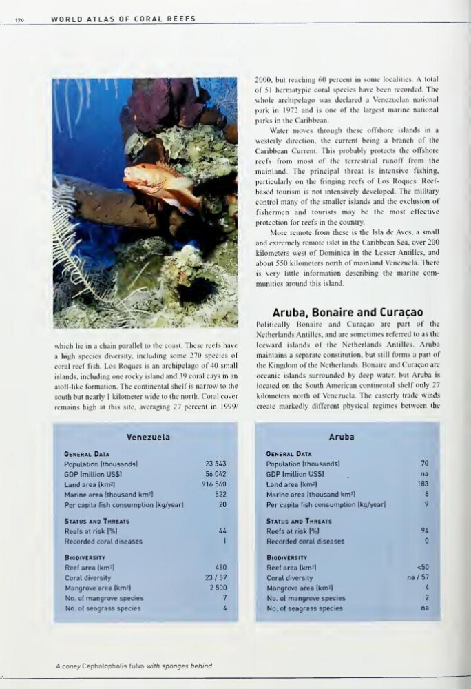
na -A coney Cephalopholis fulva with sponges behind.
WORLD ATLAS OF CORAL REEFS
which lie in a chain parallel to the coast. These reefs have
a high species diversity, including some 270 species of
coral reef fish. Los Roques is an archipelago of 40 small
islands, including one rocky island and 39 coral cays in an
atoll-like formation. The continental shelf is narrow to the
south but nearly 1 kilometer wide to the north. Coral cover
remains high at this site, averaging 27 percent in 1999/
2000, but reaching 60 percent in some localities. A total
of 5 1 hermatypic coral species have been recorded. The
whole archipelago was declared a Venezuelan national
park in 1972 and is one of the largest marine national
parks in the Caribbean.
Water moves through these offshore islands in a
westerly direction, the current being a branch of the
Caribbean Current. This probably protects the offshore
reefs from most of the terrestrial runoff from the
mainland. The principal threat is intensive fishing,
particularly on the fringing reefs of Los Roques. Reefbased tourism is not intensively developed. The military
control many of the smaller islands and the exclusion of
fishermen and tourists may be the most effective
protection for reefs in the country.
More remote from these is the Isla de Aves. a small
and extremely remote islet in the Caribbean Sea. over 200
kilometers west of Dominica in the Lesser Antilles, and
about 550 kilometers north of mainland Venezuela. There
is very little information describing the marine communities around this island.
Aruba, Bonaire and Curacao
Politically Bonaire and Curasao are part of the
Netherlands Antilles, and are sometimes referred to as the
leeward islands of the Netherlands Antilles. Aruba
maintains a separate constitution, but still forms a part of
the Kingdom of the Netherlands. Bonaire and Curasao are
oceanic islands surrounded by deep water, but Aruba is
located on the South American continental shelf only 27
kilometers north of Venezuela. The easterly trade winds
create markedly different physical regimes between the
^^^^MH
HP^V
Venezuela
^1
^m^^^^^
General Data
Population (thousands)
23 5/13
GDP (million US$1
56 0/12
Land area (km^l
916 560
Marine area (thousand km^l
522
Per capita fish consumption (kg/year)
20
Status and Threats
Reefs at risk (%l
Ai.
Recorded coral diseases
1
Biodiversity
Reef area (knn^l
480
Coral diversity
23/57
Mangrove area (km^l
2 500
No. of mangrove species
7
No. of seagrass species
4
^^H
^^^^^^^^ Aruba
^^^1
General Data
Population (thousands)
70
GDP (million US$1
na
Land area (km^l
183
Marine area (thousand km^l
6
Per capita fish consumption (kg/year)
9
Status and Threats
Reefs at risk (%l
94
Recorded coral diseases
Biodiversity
Reef area (km^l
<50
Coral diversity
na/57
Mangrove area (km^l
4
No. of mangrove species
2
No. of seagrass species
na -A coney Cephalopholis fulva with sponges behind.