

60
water column, since the height of fluid to be mixed decreases. Whether or not this hypothesis is
correct is difficult to verify, because this mechanism involves two processes interacting nonlinearly. Anyway, this process, if it actually exists, could be responsible for part of the cold
water plume developing downstream of the Anadyr Strait.
DEmt· ... VERACED
UPSL.DPIl'o'O VEl.DCITY
"us
+ : CV ut 1':'2.SII:I0 ·$ ms · 1
- · Qus S .. UICI0 ·S m s 'l
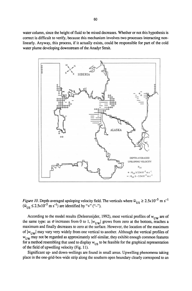
Figure 10. Depth-averaged upsloping velocity field. The verticals where wus ~ 2.5xl0- 5 m s-1
(wus ~ 2.5xlO- 5 m s-l) are identified by "+" ("-").
According to the model results (Deleersnijder, 1992), most vertical profiles of wuw are of
the same type: as (J increases from 0 to 1, IWuwl grows from zero at the bottom, reaches a
maximum and finally decreases to zero at the surface. However, the location of the maximum
of IWuwl may vary very widely from one vertical to another. Although the vertical profiles of
wuw may not be regarded as approximately self-similar, they exhibit enough common features
for a method resembling that used to display wus to be feasible for the graphical representation
of the field of upwelling velocity (Fig. 11).
Significant up- and down-wellings are found in small areas. Upwelling phenomena taking
place in the one-grid-box-wide strip along the southern open boundary clearly correspond to an
water column, since the height of fluid to be mixed decreases. Whether or not this hypothesis is
correct is difficult to verify, because this mechanism involves two processes interacting nonlinearly. Anyway, this process, if it actually exists, could be responsible for part of the cold
water plume developing downstream of the Anadyr Strait.
DEmt· ... VERACED
UPSL.DPIl'o'O VEl.DCITY
"us
+ : CV ut 1':'2.SII:I0 ·$ ms · 1
- · Qus S .. UICI0 ·S m s 'l
Figure 10. Depth-averaged upsloping velocity field. The verticals where wus ~ 2.5xl0- 5 m s-1
(wus ~ 2.5xlO- 5 m s-l) are identified by "+" ("-").
According to the model results (Deleersnijder, 1992), most vertical profiles of wuw are of
the same type: as (J increases from 0 to 1, IWuwl grows from zero at the bottom, reaches a
maximum and finally decreases to zero at the surface. However, the location of the maximum
of IWuwl may vary very widely from one vertical to another. Although the vertical profiles of
wuw may not be regarded as approximately self-similar, they exhibit enough common features
for a method resembling that used to display wus to be feasible for the graphical representation
of the field of upwelling velocity (Fig. 11).
Significant up- and down-wellings are found in small areas. Upwelling phenomena taking
place in the one-grid-box-wide strip along the southern open boundary clearly correspond to an