

(Soil-Water-Atmosphere-Plant) 1-dimensional soil moisture models were implemented. Through these models, the effect of soil and crop type, and drought severity
and time of occurrence during the year on the eventual impacts of the drought can
be highlighted. Further development of these models and expanding the modelled
area can support the development of drought adaptation and mitigation policy in
Flanders.
During the development of drought indicators and models for Flanders, a data
and information gap concerning soil moisture, a key variable in drought monitoring
and impact assessment, became apparent. Therefore, a soil moisture measuring
campaign was set up, in which 15 traditional soil moisture probes and two innovative area-integrated soil moisture probes (COsmic-ray Soil Moisture Observing
System; Zreda et al. 2012) were installed in the modelled catchments. In addition,
the use of the Soil Water Index (SWI; COPERNICUS 2015) based on remotely
sensed soil moisture data was tested in combination with ground measurements.
The results of this study were used in the development of a Flemish soil moisture
network, for which the probes will be relocated to locations distributed throughout
Flanders to assure an optimal assessment of soil moisture conditions throughout the
region in combination with satellite imagery.
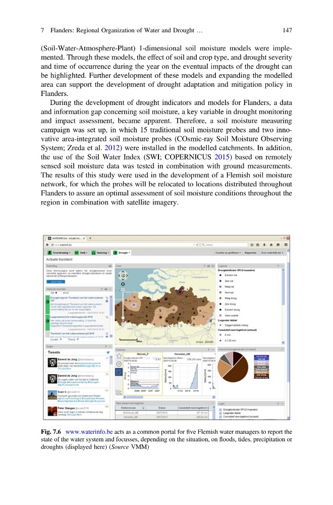
Fig. 7.6 www.waterinfo.be acts as a common portal for five Flemish water managers to report the
state of the water system and focusses, depending on the situation, on floods, tides, precipitation or
droughts (displayed here) (Source VMM)
7 Flanders: Regional Organization of Water and Drought …
147
and time of occurrence during the year on the eventual impacts of the drought can
be highlighted. Further development of these models and expanding the modelled
area can support the development of drought adaptation and mitigation policy in
Flanders.
During the development of drought indicators and models for Flanders, a data
and information gap concerning soil moisture, a key variable in drought monitoring
and impact assessment, became apparent. Therefore, a soil moisture measuring
campaign was set up, in which 15 traditional soil moisture probes and two innovative area-integrated soil moisture probes (COsmic-ray Soil Moisture Observing
System; Zreda et al. 2012) were installed in the modelled catchments. In addition,
the use of the Soil Water Index (SWI; COPERNICUS 2015) based on remotely
sensed soil moisture data was tested in combination with ground measurements.
The results of this study were used in the development of a Flemish soil moisture
network, for which the probes will be relocated to locations distributed throughout
Flanders to assure an optimal assessment of soil moisture conditions throughout the
region in combination with satellite imagery.
Fig. 7.6 www.waterinfo.be acts as a common portal for five Flemish water managers to report the
state of the water system and focusses, depending on the situation, on floods, tides, precipitation or
droughts (displayed here) (Source VMM)
7 Flanders: Regional Organization of Water and Drought …
147