

7.3.2 To Measure Is to Know: A Framework for Drought
Monitoring and Modelling
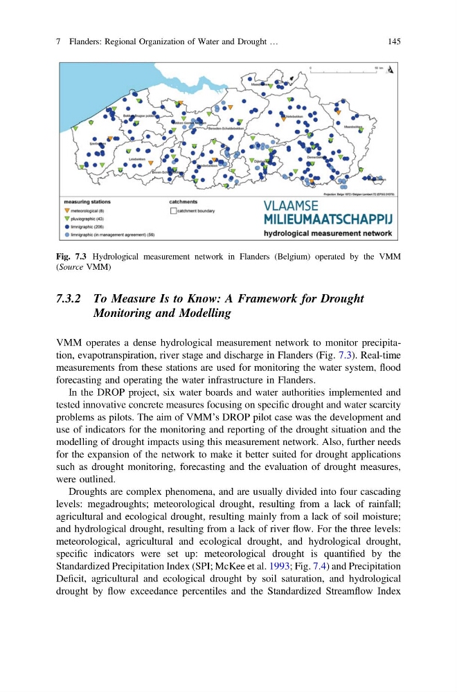
VMM operates a dense hydrological measurement network to monitor precipitation, evapotranspiration, river stage and discharge in Flanders (Fig. 7.3). Real-time
measurements from these stations are used for monitoring the water system, flood
forecasting and operating the water infrastructure in Flanders.
In the DROP project, six water boards and water authorities implemented and
tested innovative concrete measures focusing on specific drought and water scarcity
problems as pilots. The aim of VMM’s DROP pilot case was the development and
use of indicators for the monitoring and reporting of the drought situation and the
modelling of drought impacts using this measurement network. Also, further needs
for the expansion of the network to make it better suited for drought applications
such as drought monitoring, forecasting and the evaluation of drought measures,
were outlined.
Droughts are complex phenomena, and are usually divided into four cascading
levels: megadroughts; meteorological drought, resulting from a lack of rainfall;
agricultural and ecological drought, resulting mainly from a lack of soil moisture;
and hydrological drought, resulting from a lack of river flow. For the three levels:
meteorological, agricultural and ecological drought, and hydrological drought,
specific indicators were set up: meteorological drought is quantified by the
Standardized Precipitation Index (SPI; McKee et al. 1993; Fig. 7.4) and Precipitation
Deficit, agricultural and ecological drought by soil saturation, and hydrological
drought by flow exceedance percentiles and the Standardized Streamflow Index
Fig. 7.3 Hydrological measurement network in Flanders (Belgium) operated by the VMM
(Source VMM)
7 Flanders: Regional Organization of Water and Drought …
145
Monitoring and Modelling
VMM operates a dense hydrological measurement network to monitor precipitation, evapotranspiration, river stage and discharge in Flanders (Fig. 7.3). Real-time
measurements from these stations are used for monitoring the water system, flood
forecasting and operating the water infrastructure in Flanders.
In the DROP project, six water boards and water authorities implemented and
tested innovative concrete measures focusing on specific drought and water scarcity
problems as pilots. The aim of VMM’s DROP pilot case was the development and
use of indicators for the monitoring and reporting of the drought situation and the
modelling of drought impacts using this measurement network. Also, further needs
for the expansion of the network to make it better suited for drought applications
such as drought monitoring, forecasting and the evaluation of drought measures,
were outlined.
Droughts are complex phenomena, and are usually divided into four cascading
levels: megadroughts; meteorological drought, resulting from a lack of rainfall;
agricultural and ecological drought, resulting mainly from a lack of soil moisture;
and hydrological drought, resulting from a lack of river flow. For the three levels:
meteorological, agricultural and ecological drought, and hydrological drought,
specific indicators were set up: meteorological drought is quantified by the
Standardized Precipitation Index (SPI; McKee et al. 1993; Fig. 7.4) and Precipitation
Deficit, agricultural and ecological drought by soil saturation, and hydrological
drought by flow exceedance percentiles and the Standardized Streamflow Index
Fig. 7.3 Hydrological measurement network in Flanders (Belgium) operated by the VMM
(Source VMM)
7 Flanders: Regional Organization of Water and Drought …
145