

131
and artifi cially, to discharge most of its effl uent back into the rivers (SIC ICWC
2004 ). Thus, a gradual increase of water salinity in the Syrdarya and Amudarya
Rivers was observed since the 1950s (SIC ICWC 2004 ). As a result, environmental
and epidemiological fragility and hygienic and sanitary conditions are emerging as
a major problem, especially in the lower course provinces of the river basins
(SC RUz 2006 ).
10.2 General Overview of Fergana Valley
10.2.1 Geography (Geomorphological Structure)
The Fergana Valley is one of the water-rich upstream subregions of the Syrdarya
River basin. The valley is 300 km in length and 170 km in width with fl oor elevation of about 450 m above sea level (aSL) (Irrigation of Uzbekistan 1975 ). Some
literature sources quote the administrative territory of the valley as 122,100 km
2
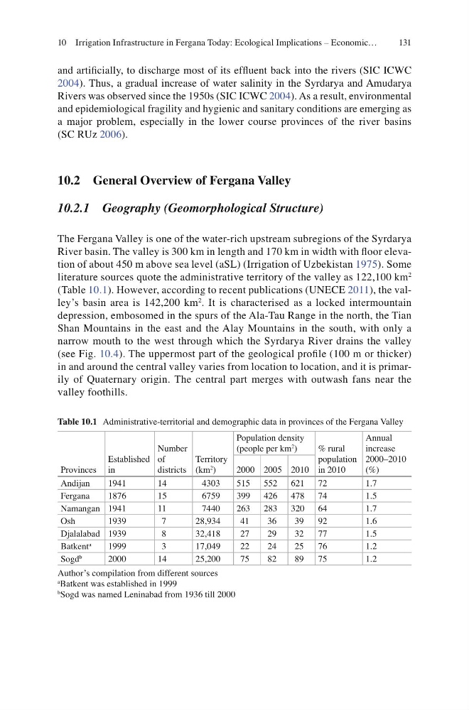
(Table 10.1 ). However, according to recent publications (UNECE 2011 ), the valley’s basin area is 142,200 km
2 . It is characterised as a locked intermountain
depression, embosomed in the spurs of the Ala-Tau Range in the north, the Tian
Shan Mountains in the east and the Alay Mountains in the south, with only a
narrow mouth to the west through which the Syrdarya River drains the valley
(see Fig. 10.4 ). The uppermost part of the geological profi le (100 m or thicker)
in and around the central valley varies from location to location, and it is primarily of Quaternary origin. The central part merges with outwash fans near the
valley foothills.
Table 10.1 Administrative-territorial and demographic data in provinces of the Fergana Valley
Provinces
Established
in
Number
of
districts
Territory
(km
2 )
Population density
(people per km
2
)
% rural
population
in 2010
Annual
increase
2000–2010
(%)
2000 2005 2010
Andijan
1941
14
4303
515 552 621 72
1.7
Fergana
1876
15
6759
399 426 478 74
1.5
Namangan 1941
11
7440
263 283 320 64
1.7
Osh
1939
7
28,934
41
36
39
92
1.6
Djalalabad 1939
8
32,418
27
29
32
77
1.5
Batkent
a
1999
3
17,049
22
24
25
76
1.2
Sogd
b
2000
14
25,200
75
82
89
75
1.2
Author’s compilation from different sources
a
Batkent was established in 1999
b
Sogd was named Leninabad from 1936 till 2000
10 Irrigation Infrastructure in Fergana Today: Ecological Implications – Economic…
and artifi cially, to discharge most of its effl uent back into the rivers (SIC ICWC
2004 ). Thus, a gradual increase of water salinity in the Syrdarya and Amudarya
Rivers was observed since the 1950s (SIC ICWC 2004 ). As a result, environmental
and epidemiological fragility and hygienic and sanitary conditions are emerging as
a major problem, especially in the lower course provinces of the river basins
(SC RUz 2006 ).
10.2 General Overview of Fergana Valley
10.2.1 Geography (Geomorphological Structure)
The Fergana Valley is one of the water-rich upstream subregions of the Syrdarya
River basin. The valley is 300 km in length and 170 km in width with fl oor elevation of about 450 m above sea level (aSL) (Irrigation of Uzbekistan 1975 ). Some
literature sources quote the administrative territory of the valley as 122,100 km
2
(Table 10.1 ). However, according to recent publications (UNECE 2011 ), the valley’s basin area is 142,200 km
2 . It is characterised as a locked intermountain
depression, embosomed in the spurs of the Ala-Tau Range in the north, the Tian
Shan Mountains in the east and the Alay Mountains in the south, with only a
narrow mouth to the west through which the Syrdarya River drains the valley
(see Fig. 10.4 ). The uppermost part of the geological profi le (100 m or thicker)
in and around the central valley varies from location to location, and it is primarily of Quaternary origin. The central part merges with outwash fans near the
valley foothills.
Table 10.1 Administrative-territorial and demographic data in provinces of the Fergana Valley
Provinces
Established
in
Number
of
districts
Territory
(km
2 )
Population density
(people per km
2
)
% rural
population
in 2010
Annual
increase
2000–2010
(%)
2000 2005 2010
Andijan
1941
14
4303
515 552 621 72
1.7
Fergana
1876
15
6759
399 426 478 74
1.5
Namangan 1941
11
7440
263 283 320 64
1.7
Osh
1939
7
28,934
41
36
39
92
1.6
Djalalabad 1939
8
32,418
27
29
32
77
1.5
Batkent
a
1999
3
17,049
22
24
25
76
1.2
Sogd
b
2000
14
25,200
75
82
89
75
1.2
Author’s compilation from different sources
a
Batkent was established in 1999
b
Sogd was named Leninabad from 1936 till 2000
10 Irrigation Infrastructure in Fergana Today: Ecological Implications – Economic…