

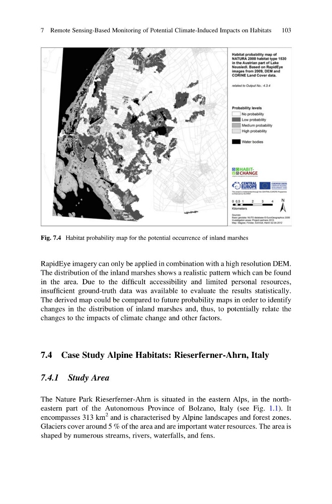
RapidEye imagery can only be applied in combination with a high resolution DEM.
The distribution of the inland marshes shows a realistic pattern which can be found
in the area. Due to the difficult accessibility and limited personal resources,
insufficient ground-truth data was available to evaluate the results statistically.
The derived map could be compared to future probability maps in order to identify
changes in the distribution of inland marshes and, thus, to potentially relate the
changes to the impacts of climate change and other factors.
7.4 Case Study Alpine Habitats: Rieserferner-Ahrn, Italy
7.4.1 Study Area
The Nature Park Rieserferner-Ahrn is situated in the eastern Alps, in the northeastern part of the Autonomous Province of Bolzano, Italy (see Fig. 1.1). It
encompasses 313 km
2 and is characterised by Alpine landscapes and forest zones.
Glaciers cover around 5 % of the area and are important water resources. The area is
shaped by numerous streams, rivers, waterfalls, and fens.
Fig. 7.4 Habitat probability map for the potential occurrence of inland marshes
7 Remote Sensing-Based Monitoring of Potential Climate-Induced Impacts on Habitats
103
The distribution of the inland marshes shows a realistic pattern which can be found
in the area. Due to the difficult accessibility and limited personal resources,
insufficient ground-truth data was available to evaluate the results statistically.
The derived map could be compared to future probability maps in order to identify
changes in the distribution of inland marshes and, thus, to potentially relate the
changes to the impacts of climate change and other factors.
7.4 Case Study Alpine Habitats: Rieserferner-Ahrn, Italy
7.4.1 Study Area
The Nature Park Rieserferner-Ahrn is situated in the eastern Alps, in the northeastern part of the Autonomous Province of Bolzano, Italy (see Fig. 1.1). It
encompasses 313 km
2 and is characterised by Alpine landscapes and forest zones.
Glaciers cover around 5 % of the area and are important water resources. The area is
shaped by numerous streams, rivers, waterfalls, and fens.
Fig. 7.4 Habitat probability map for the potential occurrence of inland marshes
7 Remote Sensing-Based Monitoring of Potential Climate-Induced Impacts on Habitats
103