

serve as an input to parameterize a spatially-explicit land use model (FALLOW, van
Noordwijk 2002), and that the combination of local knowledge and a model simulation can generate new insights into the local complexity of land use change.
The employed participatory assessment approach drew on conceptual ideas from
the Soft-System-Methodology (Checkland 2000) and on methods used by Participatory Rural Appraisal (Chambers 1994), and was conducted with an interdisciplinary research team. Following an initial reconnaissance survey, focus group
discussions were employed to analyze with local stakeholders the land use change
dynamics leading to the present village’s upland cropping patterns. Focus group
discussions covered topics such as land use history, current cropping systems, and
the causes and consequences of current land use systems. Various discussion rounds
were organized with in total 32 villagers representing different stakeholder groups,
such as administrative organizations and upland farmers. In a preliminary step, the
area of interest was defined jointly with the participants, in order to develop a
common level of understanding in time for the impending discussion sessions. For
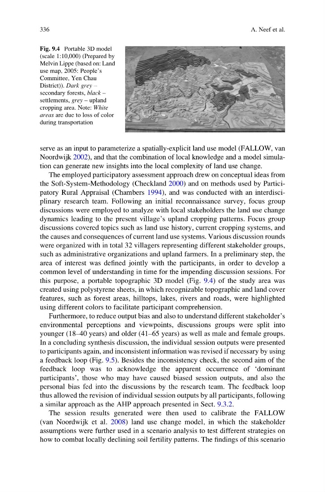
this purpose, a portable topographic 3D model (Fig. 9.4) of the study area was
created using polystyrene sheets, in which recognizable topographic and land cover
features, such as forest areas, hilltops, lakes, rivers and roads, were highlighted
using different colors to facilitate participant comprehension.
Furthermore, to reduce output bias and also to understand different stakeholder’s
environmental perceptions and viewpoints, discussions groups were split into
younger (18–40 years) and older (41–65 years) as well as male and female groups.
In a concluding synthesis discussion, the individual session outputs were presented
to participants again, and inconsistent information was revised if necessary by using
a feedback loop (Fig. 9.5). Besides the inconsistency check, the second aim of the
feedback loop was to acknowledge the apparent occurrence of ‘dominant
participants’, those who may have caused biased session outputs, and also the
personal bias fed into the discussions by the research team. The feedback loop
thus allowed the revision of individual session outputs by all participants, following
a similar approach as the AHP approach presented in Sect. 9.3.2.
The session results generated were then used to calibrate the FALLOW
(van Noordwijk et al. 2008) land use change model, in which the stakeholder
assumptions were further used in a scenario analysis to test different strategies on
how to combat locally declining soil fertility patterns. The findings of this scenario
Fig. 9.4 Portable 3D model
(scale 1:10,000) (Prepared by
Melvin Lippe (based on: Land
use map, 2005: People’s
Committee, Yen Chau
District)). Dark grey –
secondary forests, black –
settlements, grey – upland
cropping area. Note: White
areas are due to loss of color
during transportation
336
A. Neef et al.
Noordwijk 2002), and that the combination of local knowledge and a model simulation can generate new insights into the local complexity of land use change.
The employed participatory assessment approach drew on conceptual ideas from
the Soft-System-Methodology (Checkland 2000) and on methods used by Participatory Rural Appraisal (Chambers 1994), and was conducted with an interdisciplinary research team. Following an initial reconnaissance survey, focus group
discussions were employed to analyze with local stakeholders the land use change
dynamics leading to the present village’s upland cropping patterns. Focus group
discussions covered topics such as land use history, current cropping systems, and
the causes and consequences of current land use systems. Various discussion rounds
were organized with in total 32 villagers representing different stakeholder groups,
such as administrative organizations and upland farmers. In a preliminary step, the
area of interest was defined jointly with the participants, in order to develop a
common level of understanding in time for the impending discussion sessions. For
this purpose, a portable topographic 3D model (Fig. 9.4) of the study area was
created using polystyrene sheets, in which recognizable topographic and land cover
features, such as forest areas, hilltops, lakes, rivers and roads, were highlighted
using different colors to facilitate participant comprehension.
Furthermore, to reduce output bias and also to understand different stakeholder’s
environmental perceptions and viewpoints, discussions groups were split into
younger (18–40 years) and older (41–65 years) as well as male and female groups.
In a concluding synthesis discussion, the individual session outputs were presented
to participants again, and inconsistent information was revised if necessary by using
a feedback loop (Fig. 9.5). Besides the inconsistency check, the second aim of the
feedback loop was to acknowledge the apparent occurrence of ‘dominant
participants’, those who may have caused biased session outputs, and also the
personal bias fed into the discussions by the research team. The feedback loop
thus allowed the revision of individual session outputs by all participants, following
a similar approach as the AHP approach presented in Sect. 9.3.2.
The session results generated were then used to calibrate the FALLOW
(van Noordwijk et al. 2008) land use change model, in which the stakeholder
assumptions were further used in a scenario analysis to test different strategies on
how to combat locally declining soil fertility patterns. The findings of this scenario
Fig. 9.4 Portable 3D model
(scale 1:10,000) (Prepared by
Melvin Lippe (based on: Land
use map, 2005: People’s
Committee, Yen Chau
District)). Dark grey –
secondary forests, black –
settlements, grey – upland
cropping area. Note: White
areas are due to loss of color
during transportation
336
A. Neef et al.