

with attempts to incorporate participatory approaches into various forms of environmental assessment approaches (e.g., Clemens et al. 2010). The limitations of such an
approach lie in the nature of the expert’s knowledge boundaries in terms of space and
time, such as the village area. Several authors (i.e., Schuler et al. 2006; Vigiak et al.
2005) have described the drawbacks one has to bear in mind when building on
qualitative local knowledge, and other authors still, e.g., Ritzema et al. (2010),
have argued that participatory assessment approaches can compensate for information scarcity in case study areas. The study here revealed that qualitative expert
knowledge is an option in data-poor environments such as in most tropical and
subtropical areas, those where new thinking is needed in order to address the
shortcomings of traditional environmental assessment approaches.
7.5.2.2 Land Use Classification Systems
Farmers’ level of knowledge on landscape relationships and their perceptions of an
underlying logic in this area play an important (though not exclusive) role in their
management decisions (Fagerstro ¨m et al. 2001). Whereas science focuses on reductive
analysis, farmers tend to think more holistically, with limits imposed on their analysis
by what they are able to observe and experience. Land use classification systems based
on the local knowledge of farmers and local stakeholders can be a useful technique to
reduce the epistemic uncertainty inherent in environmental assessment approaches,
particularly in data-poor environments such as the mountainous areas of Southeast
Asia. As a consequence, the results from a study conducted by Lippe et al. (2011) in
Chieng Khoi commune, north-west Vietnam, will be used to illustrate the key points of
a land use classification system based on local knowledge. During a set of participative
focus group discussions (see Lippe et al. 2011 for further details), questions from the
research team focused on the preferences of and information used by farmers when
choosing an appropriate cropping or farming system in their upland fields. In this study,
participants ranked their local upland cropping preferences (maize, cassava and
intercropping) according to soil classes, with the soil colors black, red and yellow
used as the main indicators, subdivided into different transition classes (i.e., red-black,
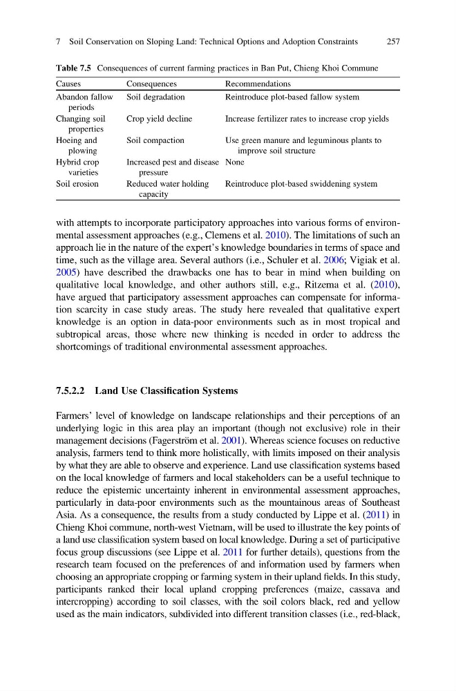
Table 7.5 Consequences of current farming practices in Ban Put, Chieng Khoi Commune
Causes
Consequences
Recommendations
Abandon fallow
periods
Soil degradation
Reintroduce plot-based fallow system
Changing soil
properties
Crop yield decline
Increase fertilizer rates to increase crop yields
Hoeing and
plowing
Soil compaction
Use green manure and leguminous plants to
improve soil structure
Hybrid crop
varieties
Increased pest and disease
pressure
None
Soil erosion
Reduced water holding
capacity
Reintroduce plot-based swiddening system
7 Soil Conservation on Sloping Land: Technical Options and Adoption Constraints
257
approach lie in the nature of the expert’s knowledge boundaries in terms of space and
time, such as the village area. Several authors (i.e., Schuler et al. 2006; Vigiak et al.
2005) have described the drawbacks one has to bear in mind when building on
qualitative local knowledge, and other authors still, e.g., Ritzema et al. (2010),
have argued that participatory assessment approaches can compensate for information scarcity in case study areas. The study here revealed that qualitative expert
knowledge is an option in data-poor environments such as in most tropical and
subtropical areas, those where new thinking is needed in order to address the
shortcomings of traditional environmental assessment approaches.
7.5.2.2 Land Use Classification Systems
Farmers’ level of knowledge on landscape relationships and their perceptions of an
underlying logic in this area play an important (though not exclusive) role in their
management decisions (Fagerstro ¨m et al. 2001). Whereas science focuses on reductive
analysis, farmers tend to think more holistically, with limits imposed on their analysis
by what they are able to observe and experience. Land use classification systems based
on the local knowledge of farmers and local stakeholders can be a useful technique to
reduce the epistemic uncertainty inherent in environmental assessment approaches,
particularly in data-poor environments such as the mountainous areas of Southeast
Asia. As a consequence, the results from a study conducted by Lippe et al. (2011) in
Chieng Khoi commune, north-west Vietnam, will be used to illustrate the key points of
a land use classification system based on local knowledge. During a set of participative
focus group discussions (see Lippe et al. 2011 for further details), questions from the
research team focused on the preferences of and information used by farmers when
choosing an appropriate cropping or farming system in their upland fields. In this study,
participants ranked their local upland cropping preferences (maize, cassava and
intercropping) according to soil classes, with the soil colors black, red and yellow
used as the main indicators, subdivided into different transition classes (i.e., red-black,
Table 7.5 Consequences of current farming practices in Ban Put, Chieng Khoi Commune
Causes
Consequences
Recommendations
Abandon fallow
periods
Soil degradation
Reintroduce plot-based fallow system
Changing soil
properties
Crop yield decline
Increase fertilizer rates to increase crop yields
Hoeing and
plowing
Soil compaction
Use green manure and leguminous plants to
improve soil structure
Hybrid crop
varieties
Increased pest and disease
pressure
None
Soil erosion
Reduced water holding
capacity
Reintroduce plot-based swiddening system
7 Soil Conservation on Sloping Land: Technical Options and Adoption Constraints
257