

The Mae Sa watershed, which is located in Mae Rim district, Chiang Mai
province in Thailand, has intensive commercialized upland agriculture. The
watershed overlaps with Suthep-Pui National Park, but agriculture is allowed
on those plots that were already used before the Park was established in 1986.
The watershed contains people from the Thai ethnic majority who live across
five villages mostly located in the central valley, as well as people from the
Hmong ethnic minority who live in seven villages located in the mountains.
None of the Hmong farmers hold secure and transferable titles over their
agricultural land, but 54 % of the Thai farmers do, in spite of the fact that
both groups have most of their fields inside the National Park. While research
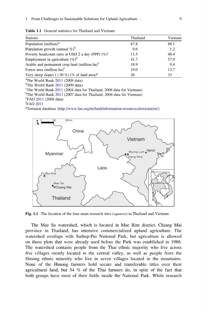
Fig. 1.1 The location of the four main research sites (squares) in Thailand and Vietnam
Table 1.1 General statistics for Thailand and Vietnam
Statistic
Thailand
Vietnam
Population (million)
a
67.8
88.1
Population growth (annual %)
b
0.6
1.2
Poverty headcount ratio at USD 2 a day (PPP) (%)
c
11.5
48.4
Employment in agriculture (%)
d
41.7
57.9
Arable and permanent crop land (million ha)
e
18.9
9.4
Forest area (million ha)
f
19.0
13.7
Very steep slopes (>30 %) (% of land area)
g
26
33
a
The World Bank 2011 (2009 data)
b
The World Bank 2011 (2009 data)
c
The World Bank 2011 (2004 data for Thailand, 2006 data for Vietnam)
d
The World Bank 2011 (2007 data for Thailand, 2004 data for Vietnam)
e
FAO 2011 (2008 data)
f
FAO 2011
g
Terrastat database (http://www.fao.org/nr/land/information-resources/terrastat/en/)
1 From Challenges to Sustainable Solutions for Upland Agriculture. . .
9
province in Thailand, has intensive commercialized upland agriculture. The
watershed overlaps with Suthep-Pui National Park, but agriculture is allowed
on those plots that were already used before the Park was established in 1986.
The watershed contains people from the Thai ethnic majority who live across
five villages mostly located in the central valley, as well as people from the
Hmong ethnic minority who live in seven villages located in the mountains.
None of the Hmong farmers hold secure and transferable titles over their
agricultural land, but 54 % of the Thai farmers do, in spite of the fact that
both groups have most of their fields inside the National Park. While research
Fig. 1.1 The location of the four main research sites (squares) in Thailand and Vietnam
Table 1.1 General statistics for Thailand and Vietnam
Statistic
Thailand
Vietnam
Population (million)
a
67.8
88.1
Population growth (annual %)
b
0.6
1.2
Poverty headcount ratio at USD 2 a day (PPP) (%)
c
11.5
48.4
Employment in agriculture (%)
d
41.7
57.9
Arable and permanent crop land (million ha)
e
18.9
9.4
Forest area (million ha)
f
19.0
13.7
Very steep slopes (>30 %) (% of land area)
g
26
33
a
The World Bank 2011 (2009 data)
b
The World Bank 2011 (2009 data)
c
The World Bank 2011 (2004 data for Thailand, 2006 data for Vietnam)
d
The World Bank 2011 (2007 data for Thailand, 2004 data for Vietnam)
e
FAO 2011 (2008 data)
f
FAO 2011
g
Terrastat database (http://www.fao.org/nr/land/information-resources/terrastat/en/)
1 From Challenges to Sustainable Solutions for Upland Agriculture. . .
9