

14.4 Functional Supplement to Global Satellite Radio Navigation Systems
263
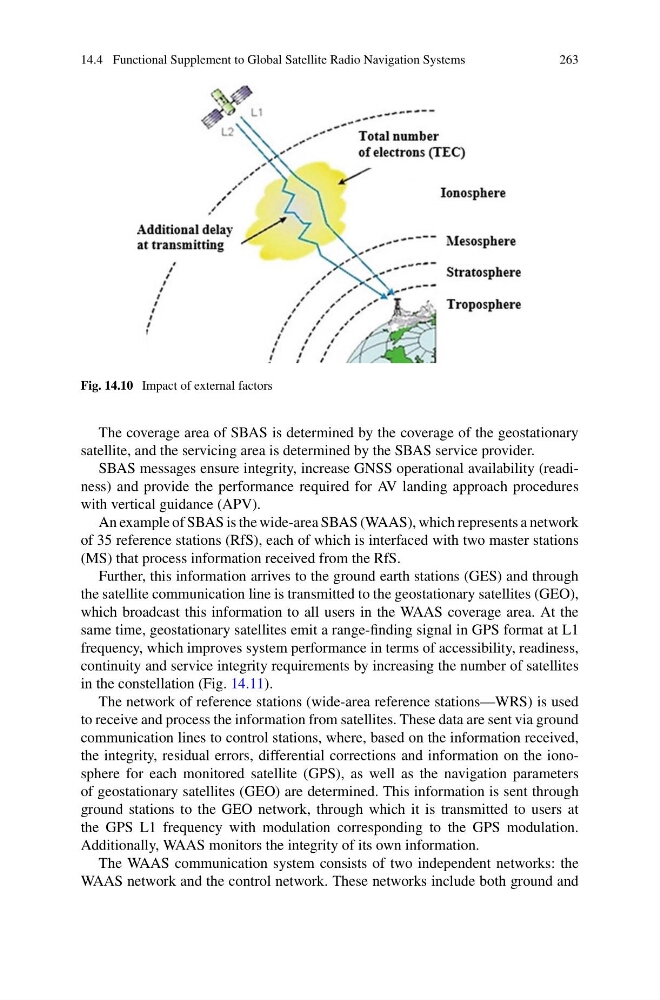
Fig. 14.10 Impact of external factors
The coverage area of SBAS is determined by the coverage of the geostationary
satellite, and the servicing area is determined by the SBAS service provider.
SBAS messages ensure integrity, increase GNSS operational availability (readiness) and provide the performance required for AV landing approach procedures
with vertical guidance (APV).
An example of SBAS is the wide-area SBAS (WAAS), which represents a network
of 35 reference stations (RfS), each of which is interfaced with two master stations
(MS) that process information received from the RfS.
Further, this information arrives to the ground earth stations (GES) and through
the satellite communication line is transmitted to the geostationary satellites (GEO),
which broadcast this information to all users in the WAAS coverage area. At the
same time, geostationary satellites emit a range-finding signal in GPS format at L1
frequency, which improves system performance in terms of accessibility, readiness,
continuity and service integrity requirements by increasing the number of satellites
in the constellation (Fig. 14.11).
The network of reference stations (wide-area reference stations—WRS) is used
to receive and process the information from satellites. These data are sent via ground
communication lines to control stations, where, based on the information received,
the integrity, residual errors, differential corrections and information on the ionosphere for each monitored satellite (GPS), as well as the navigation parameters
of geostationary satellites (GEO) are determined. This information is sent through
ground stations to the GEO network, through which it is transmitted to users at
the GPS L1 frequency with modulation corresponding to the GPS modulation.
Additionally, WAAS monitors the integrity of its own information.
The WAAS communication system consists of two independent networks: the
WAAS network and the control network. These networks include both ground and
263
Fig. 14.10 Impact of external factors
The coverage area of SBAS is determined by the coverage of the geostationary
satellite, and the servicing area is determined by the SBAS service provider.
SBAS messages ensure integrity, increase GNSS operational availability (readiness) and provide the performance required for AV landing approach procedures
with vertical guidance (APV).
An example of SBAS is the wide-area SBAS (WAAS), which represents a network
of 35 reference stations (RfS), each of which is interfaced with two master stations
(MS) that process information received from the RfS.
Further, this information arrives to the ground earth stations (GES) and through
the satellite communication line is transmitted to the geostationary satellites (GEO),
which broadcast this information to all users in the WAAS coverage area. At the
same time, geostationary satellites emit a range-finding signal in GPS format at L1
frequency, which improves system performance in terms of accessibility, readiness,
continuity and service integrity requirements by increasing the number of satellites
in the constellation (Fig. 14.11).
The network of reference stations (wide-area reference stations—WRS) is used
to receive and process the information from satellites. These data are sent via ground
communication lines to control stations, where, based on the information received,
the integrity, residual errors, differential corrections and information on the ionosphere for each monitored satellite (GPS), as well as the navigation parameters
of geostationary satellites (GEO) are determined. This information is sent through
ground stations to the GEO network, through which it is transmitted to users at
the GPS L1 frequency with modulation corresponding to the GPS modulation.
Additionally, WAAS monitors the integrity of its own information.
The WAAS communication system consists of two independent networks: the
WAAS network and the control network. These networks include both ground and