

202
11 Radar Systems of Air Transport
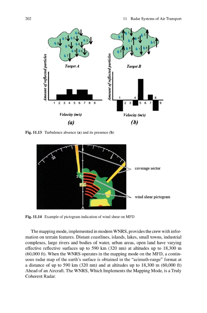
Fig. 11.13 Turbulence absence (a) and its presence (b)
Fig. 11.14 Example of pictogram indication of wind shear on MFD
The mapping mode, implemented in modern WNRS, provides the crew with information on terrain features. Distant coastlines, islands, lakes, small towns, industrial
complexes, large rivers and bodies of water, urban areas, open land have varying
effective reflective surfaces up to 590 km (320 nm) at altitudes up to 18,300 m
(60,000 ft). When the WNRS operates in the mapping mode on the MFD, a continuous radar map of the earth’s surface is obtained in the “azimuth-range” format at
a distance of up to 590 km (320 nm) and at altitudes up to 18,300 m (60,000 ft)
Ahead of an Aircraft. The WNRS, Which Implements the Mapping Mode, is a Truly
Coherent Radar.
11 Radar Systems of Air Transport
Fig. 11.13 Turbulence absence (a) and its presence (b)
Fig. 11.14 Example of pictogram indication of wind shear on MFD
The mapping mode, implemented in modern WNRS, provides the crew with information on terrain features. Distant coastlines, islands, lakes, small towns, industrial
complexes, large rivers and bodies of water, urban areas, open land have varying
effective reflective surfaces up to 590 km (320 nm) at altitudes up to 18,300 m
(60,000 ft). When the WNRS operates in the mapping mode on the MFD, a continuous radar map of the earth’s surface is obtained in the “azimuth-range” format at
a distance of up to 590 km (320 nm) and at altitudes up to 18,300 m (60,000 ft)
Ahead of an Aircraft. The WNRS, Which Implements the Mapping Mode, is a Truly
Coherent Radar.