

225
organized around the monitoring of pollution rather than the microclimate. Due to
this lack of information, it was not possible to build a homogenous framework
capable of bringing out the causes of urban overheating for the various scales.
In addition, some land management data usually available to public administrations
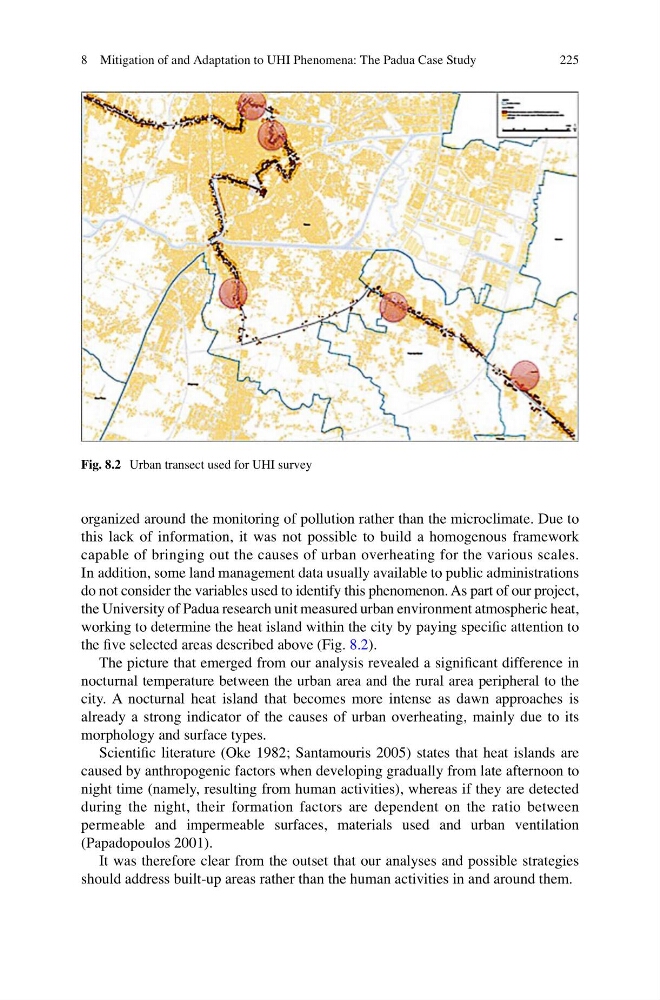
do not consider the variables used to identify this phenomenon. As part of our project,
the University of Padua research unit measured urban environment atmospheric heat,
working to determine the heat island within the city by paying specific attention to
the five selected areas described above (Fig. 8.2).
The picture that emerged from our analysis revealed a significant difference in
nocturnal temperature between the urban area and the rural area peripheral to the
city. A nocturnal heat island that becomes more intense as dawn approaches is
already a strong indicator of the causes of urban overheating, mainly due to its
morphology and surface types.
Scientific literature (Oke 1982; Santamouris 2005) states that heat islands are
caused by anthropogenic factors when developing gradually from late afternoon to
night time (namely, resulting from human activities), whereas if they are detected
during the night, their formation factors are dependent on the ratio between
permeable and impermeable surfaces, materials used and urban ventilation
(Papadopoulos 2001).
It was therefore clear from the outset that our analyses and possible strategies
should address built-up areas rather than the human activities in and around them.
Fig. 8.2 Urban transect used for UHI survey
8 Mitigation of and Adaptation to UHI Phenomena: The Padua Case Study
organized around the monitoring of pollution rather than the microclimate. Due to
this lack of information, it was not possible to build a homogenous framework
capable of bringing out the causes of urban overheating for the various scales.
In addition, some land management data usually available to public administrations
do not consider the variables used to identify this phenomenon. As part of our project,
the University of Padua research unit measured urban environment atmospheric heat,
working to determine the heat island within the city by paying specific attention to
the five selected areas described above (Fig. 8.2).
The picture that emerged from our analysis revealed a significant difference in
nocturnal temperature between the urban area and the rural area peripheral to the
city. A nocturnal heat island that becomes more intense as dawn approaches is
already a strong indicator of the causes of urban overheating, mainly due to its
morphology and surface types.
Scientific literature (Oke 1982; Santamouris 2005) states that heat islands are
caused by anthropogenic factors when developing gradually from late afternoon to
night time (namely, resulting from human activities), whereas if they are detected
during the night, their formation factors are dependent on the ratio between
permeable and impermeable surfaces, materials used and urban ventilation
(Papadopoulos 2001).
It was therefore clear from the outset that our analyses and possible strategies
should address built-up areas rather than the human activities in and around them.
Fig. 8.2 Urban transect used for UHI survey
8 Mitigation of and Adaptation to UHI Phenomena: The Padua Case Study