

224
and the intrinsic features of their settlement structure. These features are the following
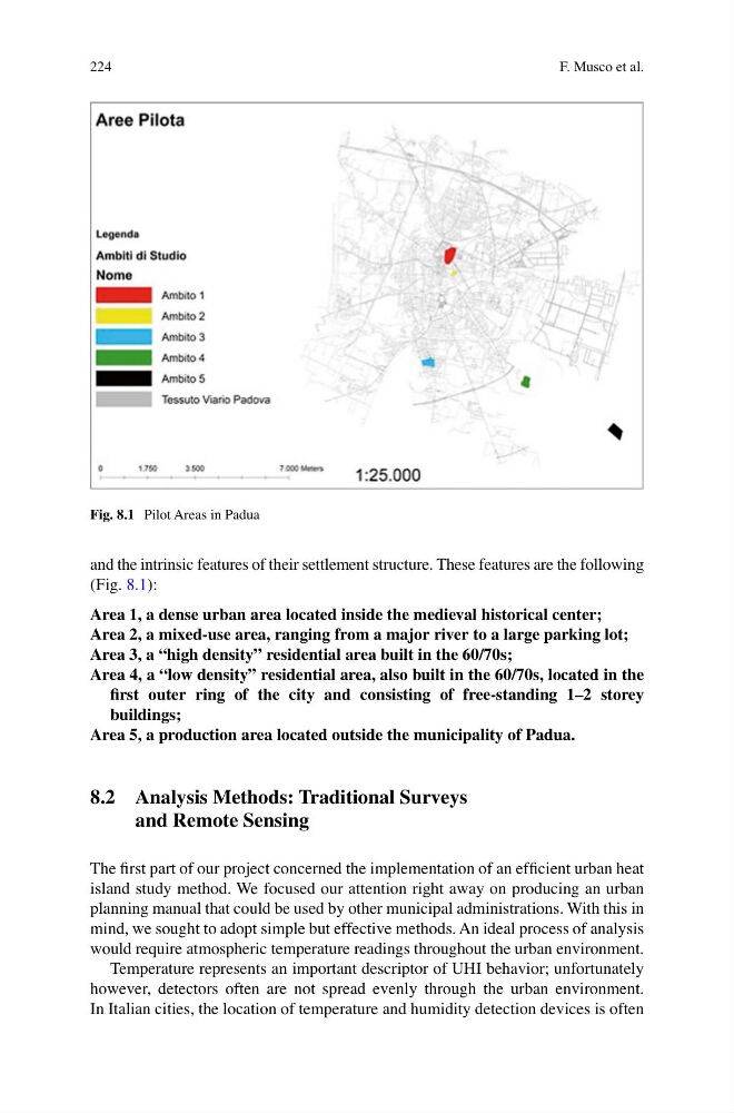
(Fig. 8.1):
Area 1, a dense urban area located inside the medieval historical center;
Area 2, a mixed-use area, ranging from a major river to a large parking lot;
Area 3, a “high density” residential area built in the 60/70s;
Area 4, a “low density” residential area, also built in the 60/70s, located in the
first outer ring of the city and consisting of free-standing 1–2 storey
buildings;
Area 5, a production area located outside the municipality of Padua.
8.2 Analysis Methods: Traditional Surveys
and Remote Sensing
The first part of our project concerned the implementation of an efficient urban heat
island study method. We focused our attention right away on producing an urban
planning manual that could be used by other municipal administrations. With this in
mind, we sought to adopt simple but effective methods. An ideal process of analysis
would require atmospheric temperature readings throughout the urban environment.
Temperature represents an important descriptor of UHI behavior; unfortunately
however, detectors often are not spread evenly through the urban environment.
In Italian cities, the location of temperature and humidity detection devices is often
Fig. 8.1 Pilot Areas in Padua
F. Musco et al.
and the intrinsic features of their settlement structure. These features are the following
(Fig. 8.1):
Area 1, a dense urban area located inside the medieval historical center;
Area 2, a mixed-use area, ranging from a major river to a large parking lot;
Area 3, a “high density” residential area built in the 60/70s;
Area 4, a “low density” residential area, also built in the 60/70s, located in the
first outer ring of the city and consisting of free-standing 1–2 storey
buildings;
Area 5, a production area located outside the municipality of Padua.
8.2 Analysis Methods: Traditional Surveys
and Remote Sensing
The first part of our project concerned the implementation of an efficient urban heat
island study method. We focused our attention right away on producing an urban
planning manual that could be used by other municipal administrations. With this in
mind, we sought to adopt simple but effective methods. An ideal process of analysis
would require atmospheric temperature readings throughout the urban environment.
Temperature represents an important descriptor of UHI behavior; unfortunately
however, detectors often are not spread evenly through the urban environment.
In Italian cities, the location of temperature and humidity detection devices is often
Fig. 8.1 Pilot Areas in Padua
F. Musco et al.