

203
7.2 Pilot Areas Identifi cation Methodology
The fi rst phase of the study was carried out by choosing fi ve areas of interest within
the city of Padua, in which to make the analysis of urban planning and surveys on
urban heat island. Such areas were selected on the basis of the location with respect
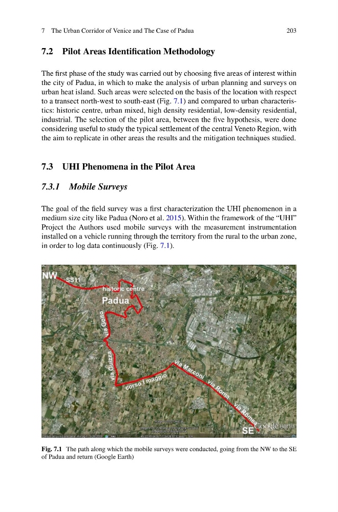
to a transect north-west to south-east (Fig. 7.1 ) and compared to urban characteristics: historic centre, urban mixed, high density residential, low-density residential,
industrial. The selection of the pilot area, between the fi ve hypothesis, were done
considering useful to study the typical settlement of the central Veneto Region, with
the aim to replicate in other areas the results and the mitigation techniques studied.
7.3 UHI Phenomena in the Pilot Area
7.3.1 Mobile Surveys
The goal of the fi eld survey was a fi rst characterization the UHI phenomenon in a
medium size city like Padua (Noro et al. 2015 ). Within the framework of the “UHI”
Project the Authors used mobile surveys with the measurement instrumentation
installed on a vehicle running through the territory from the rural to the urban zone,
in order to log data continuously (Fig. 7.1 ).
Fig. 7.1 The path along which the mobile surveys were conducted, going from the NW to the SE
of Padua and return (Google Earth)
7 The Urban Corridor of Venice and The Case of Padua
7.2 Pilot Areas Identifi cation Methodology
The fi rst phase of the study was carried out by choosing fi ve areas of interest within
the city of Padua, in which to make the analysis of urban planning and surveys on
urban heat island. Such areas were selected on the basis of the location with respect
to a transect north-west to south-east (Fig. 7.1 ) and compared to urban characteristics: historic centre, urban mixed, high density residential, low-density residential,
industrial. The selection of the pilot area, between the fi ve hypothesis, were done
considering useful to study the typical settlement of the central Veneto Region, with
the aim to replicate in other areas the results and the mitigation techniques studied.
7.3 UHI Phenomena in the Pilot Area
7.3.1 Mobile Surveys
The goal of the fi eld survey was a fi rst characterization the UHI phenomenon in a
medium size city like Padua (Noro et al. 2015 ). Within the framework of the “UHI”
Project the Authors used mobile surveys with the measurement instrumentation
installed on a vehicle running through the territory from the rural to the urban zone,
in order to log data continuously (Fig. 7.1 ).
Fig. 7.1 The path along which the mobile surveys were conducted, going from the NW to the SE
of Padua and return (Google Earth)
7 The Urban Corridor of Venice and The Case of Padua