

74
To obtain a long-term impression of the urban and rural temperature development, mean annual (urban and rural) temperatures and UHI values were derived for
a period of up to 30 years, namely from 1980 to 2011 (Modena, Prague, Stuttgart,
Warsaw), from 1994 to 2011 (Vienna, Padua), from 2000 to 2011 (Budapest).
Table 3.3 provides an overview of the time periods used for both the short-term
and the long-term analyses.
3.3 Short-Term Analyses of the Observations
Figure 3.1 shows the cumulative frequency distribution of UHI values for the
participating cities for the aforementioned summer reference week. Figures 3.2 and
3.3 show for a reference summer day (representing the reference week) the hourly
values of urban temperature and the hourly UHI values respectively.
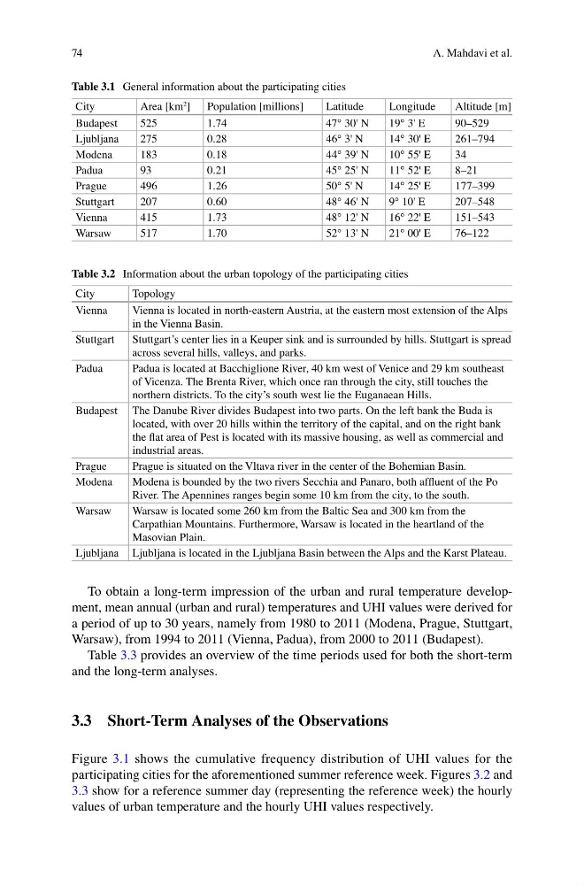
Table 3.2 Information about the urban topology of the participating cities
City
Topology
Vienna
Vienna is located in north-eastern Austria, at the eastern most extension of the Alps
in the Vienna Basin.
Stuttgart
Stuttgart’s center lies in a Keuper sink and is surrounded by hills. Stuttgart is spread
across several hills, valleys, and parks.
Padua
Padua is located at Bacchiglione River, 40 km west of Venice and 29 km southeast
of Vicenza. The Brenta River, which once ran through the city, still touches the
northern districts. To the city’s south west lie the Euganaean Hills.
Budapest The Danube River divides Budapest into two parts. On the left bank the Buda is
located, with over 20 hills within the territory of the capital, and on the right bank
the flat area of Pest is located with its massive housing, as well as commercial and
industrial areas.
Prague
Prague is situated on the Vltava river in the center of the Bohemian Basin.
Modena
Modena is bounded by the two rivers Secchia and Panaro, both affluent of the Po
River. The Apennines ranges begin some 10 km from the city, to the south.
Warsaw
Warsaw is located some 260 km from the Baltic Sea and 300 km from the
Carpathian Mountains. Furthermore, Warsaw is located in the heartland of the
Masovian Plain.
Ljubljana Ljubljana is located in the Ljubljana Basin between the Alps and the Karst Plateau.
Table 3.1 General information about the participating cities
City
Area [km
2 ] Population [millions]
Latitude
Longitude
Altitude [m]
Budapest
525
1.74
47° 30' N
19° 3' E
90–529
Ljubljana
275
0.28
46° 3' N
14° 30' E
261–794
Modena
183
0.18
44° 39' N
10° 55' E
34
Padua
93
0.21
45° 25' N
11° 52' E
8–21
Prague
496
1.26
50° 5' N
14° 25' E
177–399
Stuttgart
207
0.60
48° 46' N
9° 10' E
207–548
Vienna
415
1.73
48° 12' N
16° 22' E
151–543
Warsaw
517
1.70
52° 13' N
21° 00' E
76–122
A. Mahdavi et al.
To obtain a long-term impression of the urban and rural temperature development, mean annual (urban and rural) temperatures and UHI values were derived for
a period of up to 30 years, namely from 1980 to 2011 (Modena, Prague, Stuttgart,
Warsaw), from 1994 to 2011 (Vienna, Padua), from 2000 to 2011 (Budapest).
Table 3.3 provides an overview of the time periods used for both the short-term
and the long-term analyses.
3.3 Short-Term Analyses of the Observations
Figure 3.1 shows the cumulative frequency distribution of UHI values for the
participating cities for the aforementioned summer reference week. Figures 3.2 and
3.3 show for a reference summer day (representing the reference week) the hourly
values of urban temperature and the hourly UHI values respectively.
Table 3.2 Information about the urban topology of the participating cities
City
Topology
Vienna
Vienna is located in north-eastern Austria, at the eastern most extension of the Alps
in the Vienna Basin.
Stuttgart
Stuttgart’s center lies in a Keuper sink and is surrounded by hills. Stuttgart is spread
across several hills, valleys, and parks.
Padua
Padua is located at Bacchiglione River, 40 km west of Venice and 29 km southeast
of Vicenza. The Brenta River, which once ran through the city, still touches the
northern districts. To the city’s south west lie the Euganaean Hills.
Budapest The Danube River divides Budapest into two parts. On the left bank the Buda is
located, with over 20 hills within the territory of the capital, and on the right bank
the flat area of Pest is located with its massive housing, as well as commercial and
industrial areas.
Prague
Prague is situated on the Vltava river in the center of the Bohemian Basin.
Modena
Modena is bounded by the two rivers Secchia and Panaro, both affluent of the Po
River. The Apennines ranges begin some 10 km from the city, to the south.
Warsaw
Warsaw is located some 260 km from the Baltic Sea and 300 km from the
Carpathian Mountains. Furthermore, Warsaw is located in the heartland of the
Masovian Plain.
Ljubljana Ljubljana is located in the Ljubljana Basin between the Alps and the Karst Plateau.
Table 3.1 General information about the participating cities
City
Area [km
2 ] Population [millions]
Latitude
Longitude
Altitude [m]
Budapest
525
1.74
47° 30' N
19° 3' E
90–529
Ljubljana
275
0.28
46° 3' N
14° 30' E
261–794
Modena
183
0.18
44° 39' N
10° 55' E
34
Padua
93
0.21
45° 25' N
11° 52' E
8–21
Prague
496
1.26
50° 5' N
14° 25' E
177–399
Stuttgart
207
0.60
48° 46' N
9° 10' E
207–548
Vienna
415
1.73
48° 12' N
16° 22' E
151–543
Warsaw
517
1.70
52° 13' N
21° 00' E
76–122
A. Mahdavi et al.