

(Kanno 2017). The area had a total of 70–100 mm of rain during the 2 months
following the tsunami inundation of the farmland.
The total number of sampling sites was 344 fields chosen mostly from the
tsunami-affected farmland. For each field, samples taken from the same layer at
two separate locations were mixed to represent the field. Based on the preliminary
survey, the following procedure for sampling tsunami deposits and underlying soils
was determined. If the thickness of the tsunami deposit was 1 cm or more, the
tsunami deposit was sampled separately from the underlying original soil. If the
tsunami deposit could be separated into sandy and muddy deposits, these deposits
were sampled separately. The original soil was sampled from two layers, 0 to 10 cm
(original soil 1) and 10 to 20 cm (original soil 2) from the boundary between the
Aomori
Iwate
Miyagi
Fukushima
Ibaraki
Chiba
Epicenter
100 km
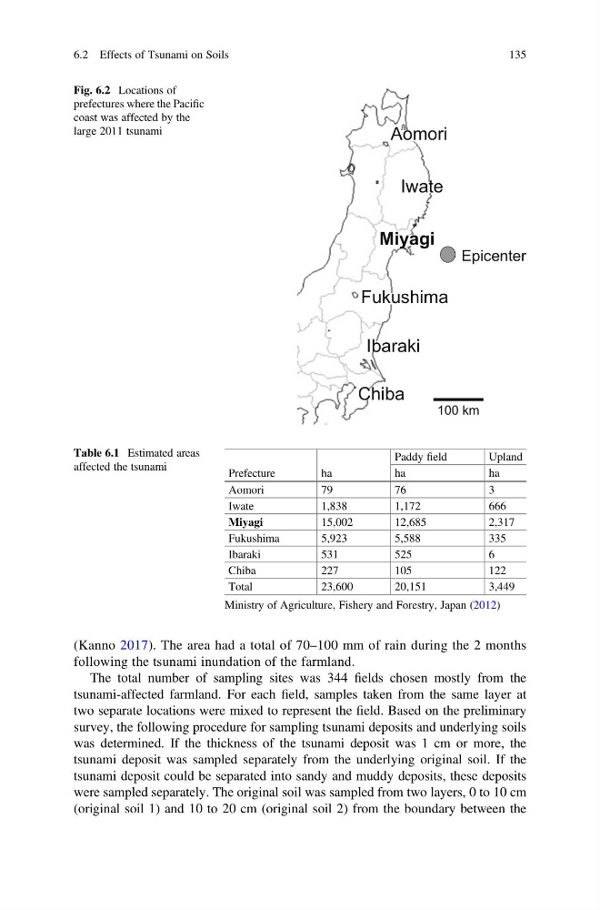
Fig. 6.2 Locations of
prefectures where the Pacific
coast was affected by the
large 2011 tsunami
Table 6.1 Estimated areas
affected the tsunami
Prefecture
ha
Paddy field
Upland
ha
ha
Aomori
79
76
3
Iwate
1,838
1,172
666
Miyagi
15,002
12,685
2,317
Fukushima
5,923
5,588
335
Ibaraki
531
525
6
Chiba
227
105
122
Total
23,600
20,151
3,449
Ministry of Agriculture, Fishery and Forestry, Japan (2012)
6.2 Effects of Tsunami on Soils
135
following the tsunami inundation of the farmland.
The total number of sampling sites was 344 fields chosen mostly from the
tsunami-affected farmland. For each field, samples taken from the same layer at
two separate locations were mixed to represent the field. Based on the preliminary
survey, the following procedure for sampling tsunami deposits and underlying soils
was determined. If the thickness of the tsunami deposit was 1 cm or more, the
tsunami deposit was sampled separately from the underlying original soil. If the
tsunami deposit could be separated into sandy and muddy deposits, these deposits
were sampled separately. The original soil was sampled from two layers, 0 to 10 cm
(original soil 1) and 10 to 20 cm (original soil 2) from the boundary between the
Aomori
Iwate
Miyagi
Fukushima
Ibaraki
Chiba
Epicenter
100 km
Fig. 6.2 Locations of
prefectures where the Pacific
coast was affected by the
large 2011 tsunami
Table 6.1 Estimated areas
affected the tsunami
Prefecture
ha
Paddy field
Upland
ha
ha
Aomori
79
76
3
Iwate
1,838
1,172
666
Miyagi
15,002
12,685
2,317
Fukushima
5,923
5,588
335
Ibaraki
531
525
6
Chiba
227
105
122
Total
23,600
20,151
3,449
Ministry of Agriculture, Fishery and Forestry, Japan (2012)
6.2 Effects of Tsunami on Soils
135