

332
H. Pundt et al.
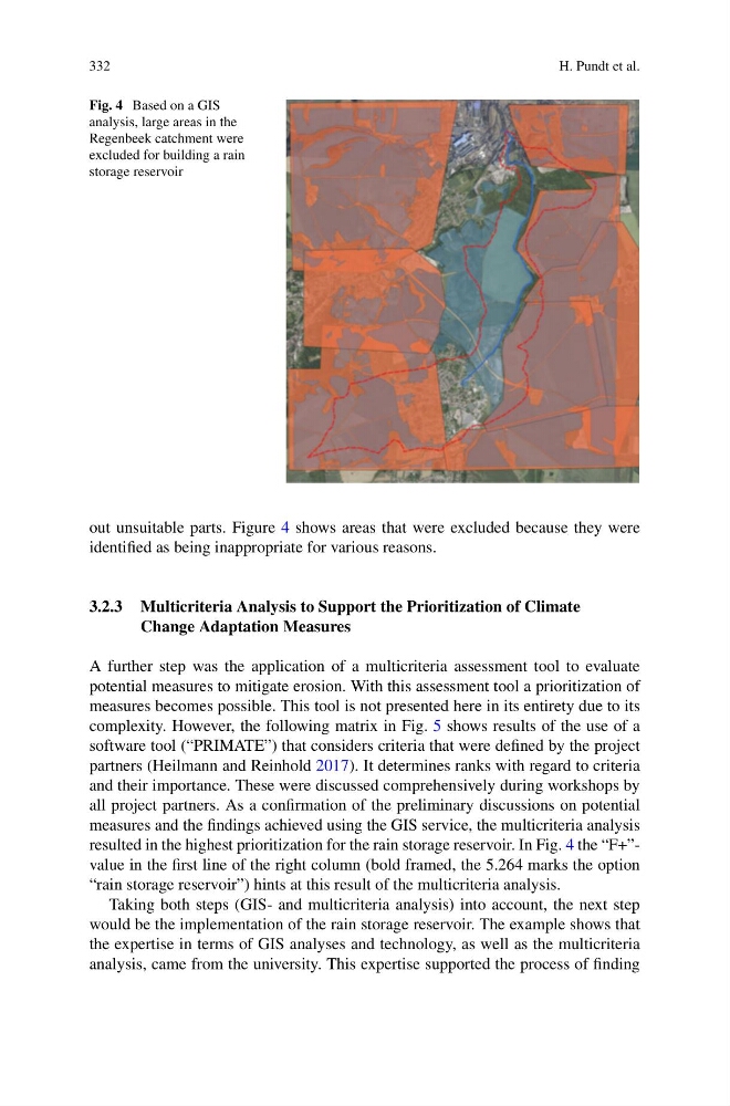
Fig. 4 Based on a GIS
analysis, large areas in the
Regenbeek catchment were
excluded for building a rain
storage reservoir
out unsuitable parts. Figure 4 shows areas that were excluded because they were
identified as being inappropriate for various reasons.
3.2.3 Multicriteria Analysis to Support the Prioritization of Climate
Change Adaptation Measures
A further step was the application of a multicriteria assessment tool to evaluate
potential measures to mitigate erosion. With this assessment tool a prioritization of
measures becomes possible. This tool is not presented here in its entirety due to its
complexity. However, the following matrix in Fig. 5 shows results of the use of a
software tool (“PRIMATE”) that considers criteria that were defined by the project
partners (Heilmann and Reinhold 2017). It determines ranks with regard to criteria
and their importance. These were discussed comprehensively during workshops by
all project partners. As a confirmation of the preliminary discussions on potential
measures and the findings achieved using the GIS service, the multicriteria analysis
resulted in the highest prioritization for the rain storage reservoir. In Fig. 4 the “F+”value in the first line of the right column (bold framed, the 5.264 marks the option
“rain storage reservoir”) hints at this result of the multicriteria analysis.
Taking both steps (GIS- and multicriteria analysis) into account, the next step
would be the implementation of the rain storage reservoir. The example shows that
the expertise in terms of GIS analyses and technology, as well as the multicriteria
analysis, came from the university. This expertise supported the process of finding
H. Pundt et al.
Fig. 4 Based on a GIS
analysis, large areas in the
Regenbeek catchment were
excluded for building a rain
storage reservoir
out unsuitable parts. Figure 4 shows areas that were excluded because they were
identified as being inappropriate for various reasons.
3.2.3 Multicriteria Analysis to Support the Prioritization of Climate
Change Adaptation Measures
A further step was the application of a multicriteria assessment tool to evaluate
potential measures to mitigate erosion. With this assessment tool a prioritization of
measures becomes possible. This tool is not presented here in its entirety due to its
complexity. However, the following matrix in Fig. 5 shows results of the use of a
software tool (“PRIMATE”) that considers criteria that were defined by the project
partners (Heilmann and Reinhold 2017). It determines ranks with regard to criteria
and their importance. These were discussed comprehensively during workshops by
all project partners. As a confirmation of the preliminary discussions on potential
measures and the findings achieved using the GIS service, the multicriteria analysis
resulted in the highest prioritization for the rain storage reservoir. In Fig. 4 the “F+”value in the first line of the right column (bold framed, the 5.264 marks the option
“rain storage reservoir”) hints at this result of the multicriteria analysis.
Taking both steps (GIS- and multicriteria analysis) into account, the next step
would be the implementation of the rain storage reservoir. The example shows that
the expertise in terms of GIS analyses and technology, as well as the multicriteria
analysis, came from the university. This expertise supported the process of finding