

186
located, with altitude range of 700–1140 m. The valley is enclosed by the Maleševski
Mountains on the east, by the Ograzhden Mountain on the south-southeast and by
the Plačkovica and Obozna on the west. The average annual precipitation amounts
to about 500 mm with significant variations from year to year, as well as in the different sub-regions (Lazarevski 1993). The precipitation is mostly related to and
conditioned by the Mediterranean cyclones (Lazarevski 1993). During the summer
period, the region is most often found in the centre of the subtropical anticyclone,
which causes warm and dry summers. From the central area of the region, as the
driest area, the average annual precipitation increases in all directions, because of
either the increase in the influence of the Mediterranean climate or the increase in
altitude (Lazarevski 1993). In the region are distinguished about ten climaticvegetation soil areas with considerably heterogeneous climate, soil and vegetation
characteristics (Lazarevski 1993). Regarding the demographic structure in the
region of the Bregalnica basin, only 4% of the populated areas belong to the category of urban areas, while 96% of the total populated areas are categorized as rural
areas. Considering land use, the region is considerably diverse. Along the course of
the Bregalnica river dominate agricultural cultivated lands. About 30% belong to
the forest regions, localized around the Maleševska valley, represented by the
Maleševski Mountains, and then around the Kočani valley, represented on the one
side by the Osogovo Mountains and by Plačkovica on the other side. The investigated area that covers the basin of the river Bregalnica lies on the two main tectonic
units – the Serbian-Macedonian massive and the Vardar zone (Dumurdzanov et al.
2004). The polyphasal Neogene deformations through the insignificant movements
associated with the volcanic activities had direct influence on the gradual formation
of the reefs and the formation of deposits in the existing basins. From the middle
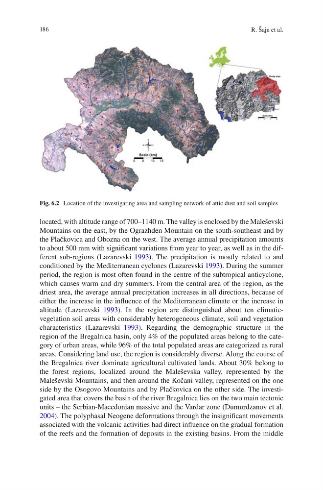
Fig. 6.2 Location of the investigating area and sampling network of attic dust and soil samples
R. Šajn et al.
located, with altitude range of 700–1140 m. The valley is enclosed by the Maleševski
Mountains on the east, by the Ograzhden Mountain on the south-southeast and by
the Plačkovica and Obozna on the west. The average annual precipitation amounts
to about 500 mm with significant variations from year to year, as well as in the different sub-regions (Lazarevski 1993). The precipitation is mostly related to and
conditioned by the Mediterranean cyclones (Lazarevski 1993). During the summer
period, the region is most often found in the centre of the subtropical anticyclone,
which causes warm and dry summers. From the central area of the region, as the
driest area, the average annual precipitation increases in all directions, because of
either the increase in the influence of the Mediterranean climate or the increase in
altitude (Lazarevski 1993). In the region are distinguished about ten climaticvegetation soil areas with considerably heterogeneous climate, soil and vegetation
characteristics (Lazarevski 1993). Regarding the demographic structure in the
region of the Bregalnica basin, only 4% of the populated areas belong to the category of urban areas, while 96% of the total populated areas are categorized as rural
areas. Considering land use, the region is considerably diverse. Along the course of
the Bregalnica river dominate agricultural cultivated lands. About 30% belong to
the forest regions, localized around the Maleševska valley, represented by the
Maleševski Mountains, and then around the Kočani valley, represented on the one
side by the Osogovo Mountains and by Plačkovica on the other side. The investigated area that covers the basin of the river Bregalnica lies on the two main tectonic
units – the Serbian-Macedonian massive and the Vardar zone (Dumurdzanov et al.
2004). The polyphasal Neogene deformations through the insignificant movements
associated with the volcanic activities had direct influence on the gradual formation
of the reefs and the formation of deposits in the existing basins. From the middle
Fig. 6.2 Location of the investigating area and sampling network of attic dust and soil samples
R. Šajn et al.