

Geomorphology of Dakhla Depression
67
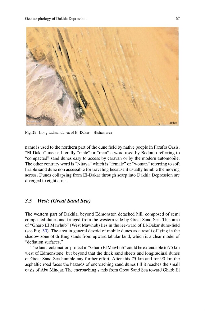
Fig. 29 Longitudinal dunes of El-Dakar—Hishan area
name is used to the northern part of the dune field by native people in Farafra Oasis.
“El-Dakar” means literally “male” or “man” a word used by Bedouin referring to
“compacted” sand dunes easy to access by caravan or by the modern automobile.
The other contrary word is “Nitaya” which is “female” or “woman” referring to soft
friable sand dune non accessible for traveling because it usually humble the moving
across. Dunes collapsing from El-Dakar through scarp into Dakhla Depression are
diverged to eight arms.
3.5 West: (Great Sand Sea)
The western part of Dakhla, beyond Edmonston detached hill, composed of semi
compacted dunes and fringed from the western side by Great Sand Sea. This area
of “Gharb El Mawhub” (West Mawhub) lies in the lee-ward of El-Dakar dune-field
(see Fig. 30). The area in general devoid of mobile dunes as a result of lying in the
shadow zone of drifting sands from upward tabular land, which is a clear model of
“deflation surfaces.”
The land reclamation project in “Gharb El Mawhub” could be extendable to 75 km
west of Edmonstone, but beyond that the thick sand sheets and longitudinal dunes
of Great Sand Sea humble any further effort. After this 75 km and for 90 km the
asphaltic road faces the hazards of encroaching sand dunes till it reaches the small
oasis of Abu Minqar. The encroaching sands from Great Sand Sea toward Gharb El
67
Fig. 29 Longitudinal dunes of El-Dakar—Hishan area
name is used to the northern part of the dune field by native people in Farafra Oasis.
“El-Dakar” means literally “male” or “man” a word used by Bedouin referring to
“compacted” sand dunes easy to access by caravan or by the modern automobile.
The other contrary word is “Nitaya” which is “female” or “woman” referring to soft
friable sand dune non accessible for traveling because it usually humble the moving
across. Dunes collapsing from El-Dakar through scarp into Dakhla Depression are
diverged to eight arms.
3.5 West: (Great Sand Sea)
The western part of Dakhla, beyond Edmonston detached hill, composed of semi
compacted dunes and fringed from the western side by Great Sand Sea. This area
of “Gharb El Mawhub” (West Mawhub) lies in the lee-ward of El-Dakar dune-field
(see Fig. 30). The area in general devoid of mobile dunes as a result of lying in the
shadow zone of drifting sands from upward tabular land, which is a clear model of
“deflation surfaces.”
The land reclamation project in “Gharb El Mawhub” could be extendable to 75 km
west of Edmonstone, but beyond that the thick sand sheets and longitudinal dunes
of Great Sand Sea humble any further effort. After this 75 km and for 90 km the
asphaltic road faces the hazards of encroaching sand dunes till it reaches the small
oasis of Abu Minqar. The encroaching sands from Great Sand Sea toward Gharb El