

Hydrogeophysical Investigations Using DC Resistivity …
263
are delineation of depths, thicknesses, and aquifer boundaries, in addition to determination of saline and freshwater boundaries and contamination level in groundwater
(Zohdy 1989; Gemail et al. 2004, 2017).
The present objective is to evaluate the groundwater potentialities using an integrated approach of DC resistivity sounding survey, boreholes information, and TDS
data collected from topmost aquifer zone of Nubian Sandstone aquifer. Moreover,
delineating the impact of normal faults on the recharge of the upper aquifer zone and
consequently the groundwater potentials as a tool for future groundwater management in the area. This type of study will support the decision makers to preserve and
manage the groundwater potentialities in such an arid region.
2 Geological and Hydrogeological Setting
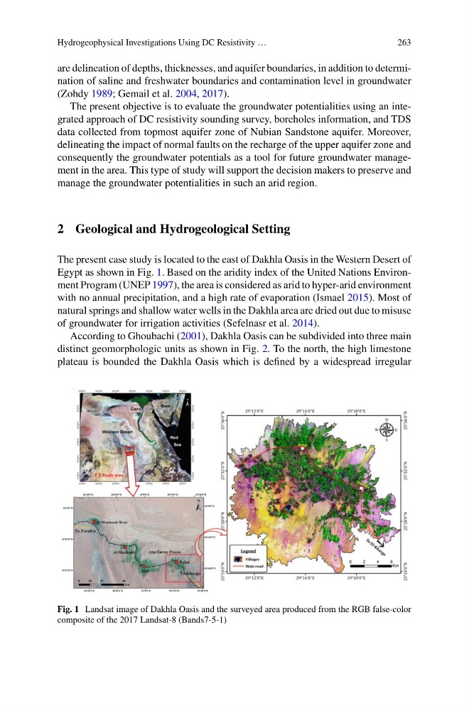
The present case study is located to the east of Dakhla Oasis in the Western Desert of
Egypt as shown in Fig. 1. Based on the aridity index of the United Nations Environment Program (UNEP 1997), the area is considered as arid to hyper-arid environment
with no annual precipitation, and a high rate of evaporation (Ismael 2015). Most of
natural springs and shallow water wells in the Dakhla area are dried out due to misuse
of groundwater for irrigation activities (Sefelnasr et al. 2014).
According to Ghoubachi (2001), Dakhla Oasis can be subdivided into three main
distinct geomorphologic units as shown in Fig. 2. To the north, the high limestone
plateau is bounded the Dakhla Oasis which is defined by a widespread irregular
Fig. 1 Landsat image of Dakhla Oasis and the surveyed area produced from the RGB false-color
composite of the 2017 Landsat-8 (Bands7-5-1)
263
are delineation of depths, thicknesses, and aquifer boundaries, in addition to determination of saline and freshwater boundaries and contamination level in groundwater
(Zohdy 1989; Gemail et al. 2004, 2017).
The present objective is to evaluate the groundwater potentialities using an integrated approach of DC resistivity sounding survey, boreholes information, and TDS
data collected from topmost aquifer zone of Nubian Sandstone aquifer. Moreover,
delineating the impact of normal faults on the recharge of the upper aquifer zone and
consequently the groundwater potentials as a tool for future groundwater management in the area. This type of study will support the decision makers to preserve and
manage the groundwater potentialities in such an arid region.
2 Geological and Hydrogeological Setting
The present case study is located to the east of Dakhla Oasis in the Western Desert of
Egypt as shown in Fig. 1. Based on the aridity index of the United Nations Environment Program (UNEP 1997), the area is considered as arid to hyper-arid environment
with no annual precipitation, and a high rate of evaporation (Ismael 2015). Most of
natural springs and shallow water wells in the Dakhla area are dried out due to misuse
of groundwater for irrigation activities (Sefelnasr et al. 2014).
According to Ghoubachi (2001), Dakhla Oasis can be subdivided into three main
distinct geomorphologic units as shown in Fig. 2. To the north, the high limestone
plateau is bounded the Dakhla Oasis which is defined by a widespread irregular
Fig. 1 Landsat image of Dakhla Oasis and the surveyed area produced from the RGB false-color
composite of the 2017 Landsat-8 (Bands7-5-1)