

Hydrologeological and Hydrological …
187
2 Climate
The study area is located in the most arid belt in Egypt as a part from the Great Sahara.
The annual rainfall is less than 20 mm/year. Dakhla Basin does not receive surface
recharge to increase the groundwater potentiality of the main Nubian Sandstone
aquifer and it may receive a sort of base flow from adjacent groundwater basins in
Libya, Chad and Sudan.
3 Geologic Setting
The Nubian Sandstone section covering approximately 2 million km
2 in the northeastern portion of the Great Sahara and has been estimated to contain at least
50,000 km
3 of groundwater (Thorweihe 1990). It rests uncomfortably upon the
Crystalline Pre-Cambrian basement rocks which are exposed in the south, and
southwest. The Bir Tarfawi uplifted basement rock (mainly Granite) divided the
Western Desert into two basins: the Dakhla Basin (Fig. 3) in the west and the Kharga
Depression in the east.
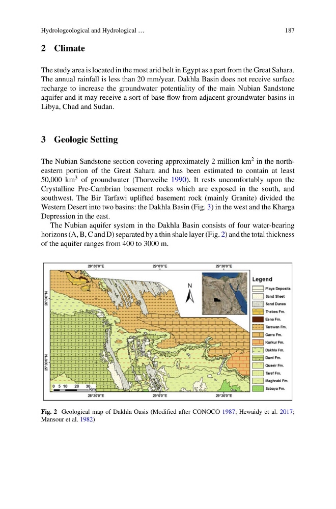
The Nubian aquifer system in the Dakhla Basin consists of four water-bearing
horizons (A, B, C and D) separated by a thin shale layer (Fig. 2) and the total thickness
of the aquifer ranges from 400 to 3000 m.
Fig. 2 Geological map of Dakhla Oasis (Modified after CONOCO 1987; Hewaidy et al. 2017;
Mansour et al. 1982)
187
2 Climate
The study area is located in the most arid belt in Egypt as a part from the Great Sahara.
The annual rainfall is less than 20 mm/year. Dakhla Basin does not receive surface
recharge to increase the groundwater potentiality of the main Nubian Sandstone
aquifer and it may receive a sort of base flow from adjacent groundwater basins in
Libya, Chad and Sudan.
3 Geologic Setting
The Nubian Sandstone section covering approximately 2 million km
2 in the northeastern portion of the Great Sahara and has been estimated to contain at least
50,000 km
3 of groundwater (Thorweihe 1990). It rests uncomfortably upon the
Crystalline Pre-Cambrian basement rocks which are exposed in the south, and
southwest. The Bir Tarfawi uplifted basement rock (mainly Granite) divided the
Western Desert into two basins: the Dakhla Basin (Fig. 3) in the west and the Kharga
Depression in the east.
The Nubian aquifer system in the Dakhla Basin consists of four water-bearing
horizons (A, B, C and D) separated by a thin shale layer (Fig. 2) and the total thickness
of the aquifer ranges from 400 to 3000 m.
Fig. 2 Geological map of Dakhla Oasis (Modified after CONOCO 1987; Hewaidy et al. 2017;
Mansour et al. 1982)