

140
A. B. A. Belal et al.
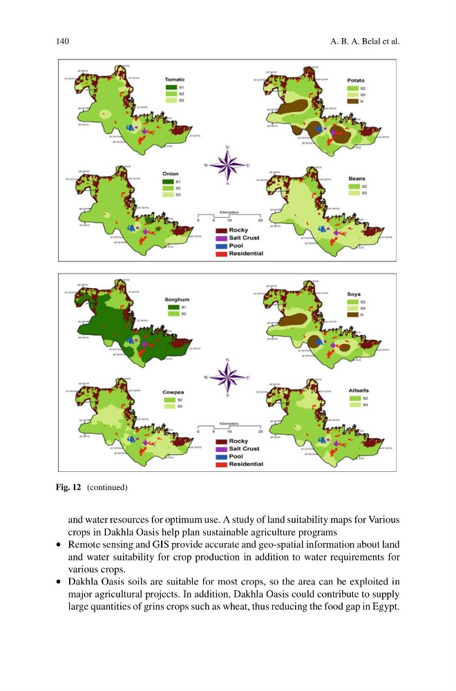
Fig. 12 (continued)
and water resources for optimum use. A study of land suitability maps for Various
crops in Dakhla Oasis help plan sustainable agriculture programs
• Remote sensing and GIS provide accurate and geo-spatial information about land
and water suitability for crop production in addition to water requirements for
various crops.
• Dakhla Oasis soils are suitable for most crops, so the area can be exploited in
major agricultural projects. In addition, Dakhla Oasis could contribute to supply
large quantities of grins crops such as wheat, thus reducing the food gap in Egypt.
A. B. A. Belal et al.
Fig. 12 (continued)
and water resources for optimum use. A study of land suitability maps for Various
crops in Dakhla Oasis help plan sustainable agriculture programs
• Remote sensing and GIS provide accurate and geo-spatial information about land
and water suitability for crop production in addition to water requirements for
various crops.
• Dakhla Oasis soils are suitable for most crops, so the area can be exploited in
major agricultural projects. In addition, Dakhla Oasis could contribute to supply
large quantities of grins crops such as wheat, thus reducing the food gap in Egypt.