

68
A. Hysa
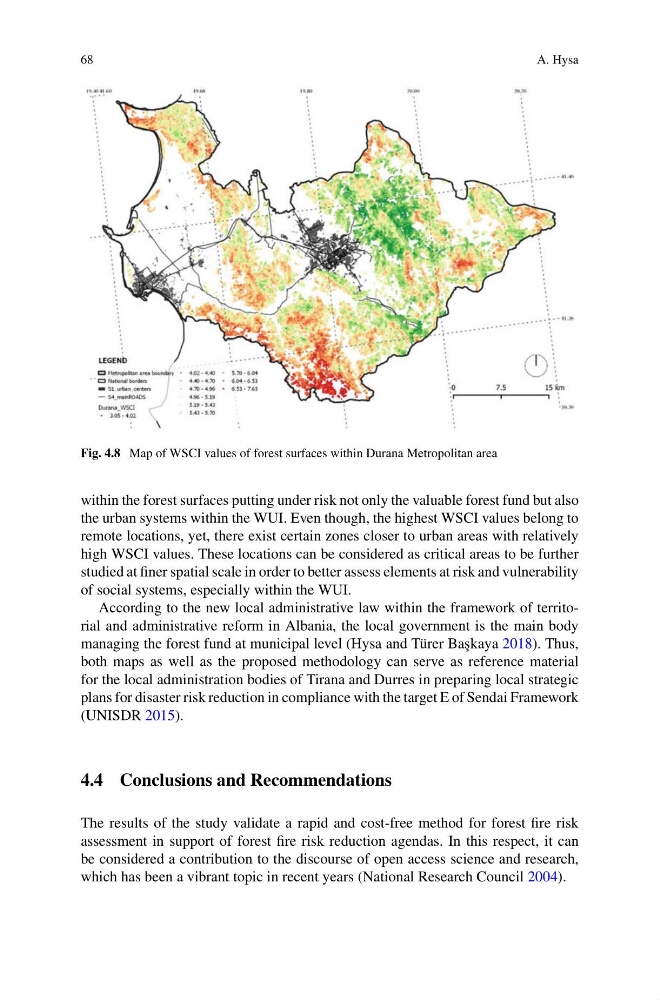
Fig. 4.8 Map of WSCI values of forest surfaces within Durana Metropolitan area
within the forest surfaces putting under risk not only the valuable forest fund but also
the urban systems within the WUI. Even though, the highest WSCI values belong to
remote locations, yet, there exist certain zones closer to urban areas with relatively
high WSCI values. These locations can be considered as critical areas to be further
studied at finer spatial scale in order to better assess elements at risk and vulnerability
of social systems, especially within the WUI.
According to the new local administrative law within the framework of territorial and administrative reform in Albania, the local government is the main body
managing the forest fund at municipal level (Hysa and Türer Ba¸ skaya 2018). Thus,
both maps as well as the proposed methodology can serve as reference material
for the local administration bodies of Tirana and Durres in preparing local strategic
plans for disaster risk reduction in compliance with the target E of Sendai Framework
(UNISDR 2015).
4.4 Conclusions and Recommendations
The results of the study validate a rapid and cost-free method for forest fire risk
assessment in support of forest fire risk reduction agendas. In this respect, it can
be considered a contribution to the discourse of open access science and research,
which has been a vibrant topic in recent years (National Research Council 2004).
A. Hysa
Fig. 4.8 Map of WSCI values of forest surfaces within Durana Metropolitan area
within the forest surfaces putting under risk not only the valuable forest fund but also
the urban systems within the WUI. Even though, the highest WSCI values belong to
remote locations, yet, there exist certain zones closer to urban areas with relatively
high WSCI values. These locations can be considered as critical areas to be further
studied at finer spatial scale in order to better assess elements at risk and vulnerability
of social systems, especially within the WUI.
According to the new local administrative law within the framework of territorial and administrative reform in Albania, the local government is the main body
managing the forest fund at municipal level (Hysa and Türer Ba¸ skaya 2018). Thus,
both maps as well as the proposed methodology can serve as reference material
for the local administration bodies of Tirana and Durres in preparing local strategic
plans for disaster risk reduction in compliance with the target E of Sendai Framework
(UNISDR 2015).
4.4 Conclusions and Recommendations
The results of the study validate a rapid and cost-free method for forest fire risk
assessment in support of forest fire risk reduction agendas. In this respect, it can
be considered a contribution to the discourse of open access science and research,
which has been a vibrant topic in recent years (National Research Council 2004).