

54
A. Hysa
agglomeration, industrial connecting strip, the inhabited agricultural plain, and the
embracing forest surfaces (Fabi and Piovene 2016).
Tirana-Durres area is defined as metropolitan zone based on being a large urban
area, composed of several interconnected agglomerations, having at least 500,000
inhabitants, being distinct for their economic potential, and possessing considerable national and international level impact (Ahrend et al. 2014; INSTAT 2014).
Durana is considered a metropolitan “region” having the features of a vague space,
defined by strong geographical and environmental conditions, common production
patterns, transportation networks, labor markets, social interaction, and complex
social-ecological interdependencies (Keating 1998).
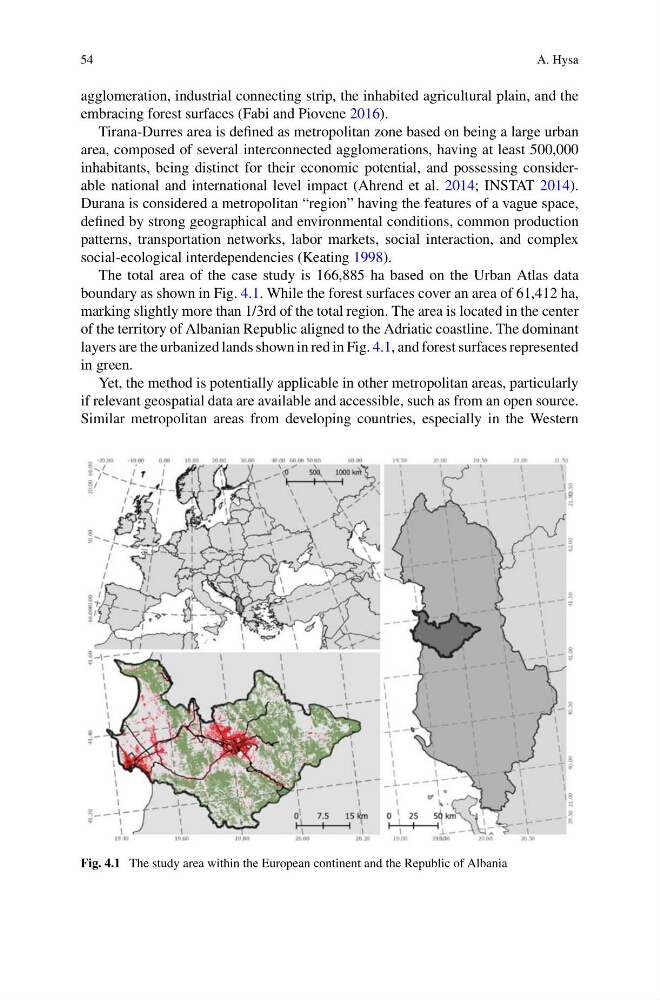
The total area of the case study is 166,885 ha based on the Urban Atlas data
boundary as shown in Fig. 4.1. While the forest surfaces cover an area of 61,412 ha,
marking slightly more than 1/3rd of the total region. The area is located in the center
of the territory of Albanian Republic aligned to the Adriatic coastline. The dominant
layers are the urbanized lands shown in red in Fig. 4.1, and forest surfaces represented
in green.
Yet, the method is potentially applicable in other metropolitan areas, particularly
if relevant geospatial data are available and accessible, such as from an open source.
Similar metropolitan areas from developing countries, especially in the Western
Fig. 4.1 The study area within the European continent and the Republic of Albania
A. Hysa
agglomeration, industrial connecting strip, the inhabited agricultural plain, and the
embracing forest surfaces (Fabi and Piovene 2016).
Tirana-Durres area is defined as metropolitan zone based on being a large urban
area, composed of several interconnected agglomerations, having at least 500,000
inhabitants, being distinct for their economic potential, and possessing considerable national and international level impact (Ahrend et al. 2014; INSTAT 2014).
Durana is considered a metropolitan “region” having the features of a vague space,
defined by strong geographical and environmental conditions, common production
patterns, transportation networks, labor markets, social interaction, and complex
social-ecological interdependencies (Keating 1998).
The total area of the case study is 166,885 ha based on the Urban Atlas data
boundary as shown in Fig. 4.1. While the forest surfaces cover an area of 61,412 ha,
marking slightly more than 1/3rd of the total region. The area is located in the center
of the territory of Albanian Republic aligned to the Adriatic coastline. The dominant
layers are the urbanized lands shown in red in Fig. 4.1, and forest surfaces represented
in green.
Yet, the method is potentially applicable in other metropolitan areas, particularly
if relevant geospatial data are available and accessible, such as from an open source.
Similar metropolitan areas from developing countries, especially in the Western
Fig. 4.1 The study area within the European continent and the Republic of Albania