

7 Comparative GIS-Based Assessment …
123
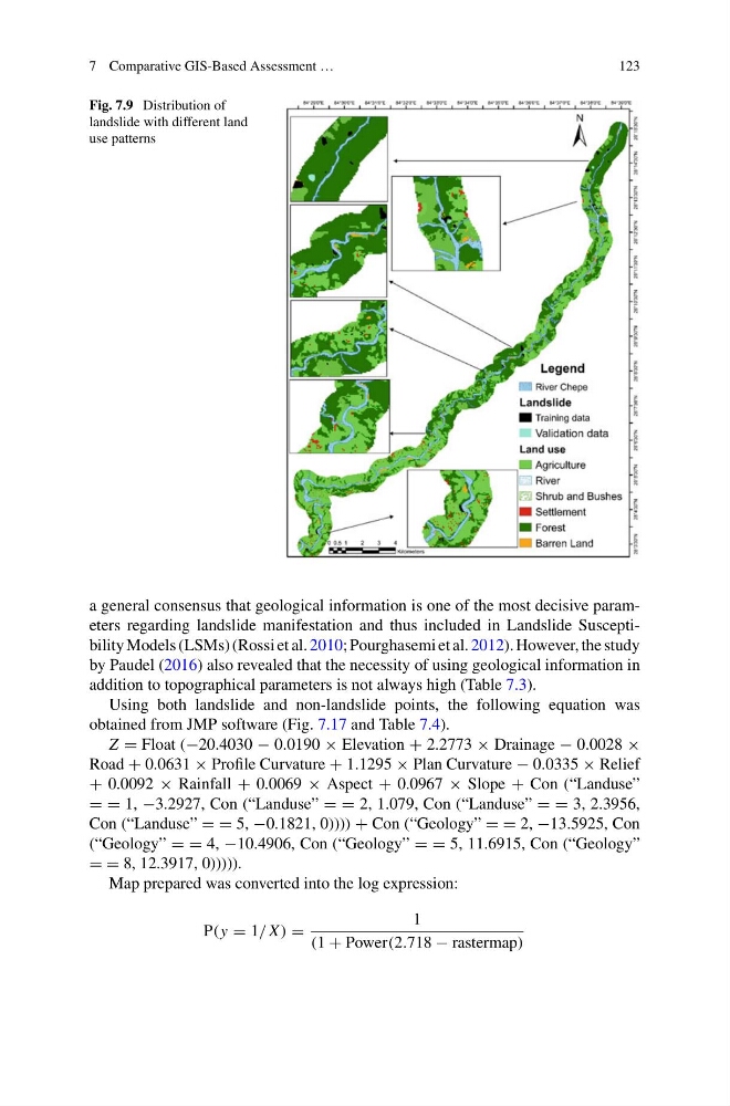
Fig. 7.9 Distribution of
landslide with different land
use patterns
a general consensus that geological information is one of the most decisive parameters regarding landslide manifestation and thus included in Landslide Susceptibility Models (LSMs) (Rossi et al. 2010; Pourghasemi et al. 2012). However, the study
by Paudel (2016) also revealed that the necessity of using geological information in
addition to topographical parameters is not always high (Table 7.3).
Using both landslide and non-landslide points, the following equation was
obtained from JMP software (Fig. 7.17 and Table 7.4).
Z = Float (−20.4030 − 0.0190 × Elevation + 2.2773 × Drainage − 0.0028 ×
Road + 0.0631 × Profile Curvature + 1.1295 × Plan Curvature − 0.0335 × Relief
+ 0.0092 × Rainfall + 0.0069 × Aspect + 0.0967 × Slope + Con (“Landuse”
= = 1, −3.2927, Con (“Landuse” = = 2, 1.079, Con (“Landuse” = = 3, 2.3956,
Con (“Landuse” = = 5, −0.1821, 0)))) + Con (“Geology” = = 2, −13.5925, Con
(“Geology” = = 4, −10.4906, Con (“Geology” = = 5, 11.6915, Con (“Geology”
= = 8, 12.3917, 0))))).
Map prepared was converted into the log expression:
P(y = 1/ X ) =
1
(1 + Power(2.718 − rastermap)
123
Fig. 7.9 Distribution of
landslide with different land
use patterns
a general consensus that geological information is one of the most decisive parameters regarding landslide manifestation and thus included in Landslide Susceptibility Models (LSMs) (Rossi et al. 2010; Pourghasemi et al. 2012). However, the study
by Paudel (2016) also revealed that the necessity of using geological information in
addition to topographical parameters is not always high (Table 7.3).
Using both landslide and non-landslide points, the following equation was
obtained from JMP software (Fig. 7.17 and Table 7.4).
Z = Float (−20.4030 − 0.0190 × Elevation + 2.2773 × Drainage − 0.0028 ×
Road + 0.0631 × Profile Curvature + 1.1295 × Plan Curvature − 0.0335 × Relief
+ 0.0092 × Rainfall + 0.0069 × Aspect + 0.0967 × Slope + Con (“Landuse”
= = 1, −3.2927, Con (“Landuse” = = 2, 1.079, Con (“Landuse” = = 3, 2.3956,
Con (“Landuse” = = 5, −0.1821, 0)))) + Con (“Geology” = = 2, −13.5925, Con
(“Geology” = = 4, −10.4906, Con (“Geology” = = 5, 11.6915, Con (“Geology”
= = 8, 12.3917, 0))))).
Map prepared was converted into the log expression:
P(y = 1/ X ) =
1
(1 + Power(2.718 − rastermap)