

114
K. Shrestha et al.
(Carson and Kirk 1972); Altitude controlled by several geologic and geomorphological processes (Pourghasemi 2008); Land use characteristics being important for the
stability of slopes (Ocakoglu et al. 2002); and Road constructed results an increase
in stress on the back of the slope, because of changes in topography and decrease of
load on toe, some tension cracks may develop (Pourghasemi et al. 2012).
7.4 Landslide Susceptibility Modeling
Datasets from 73 landslides were divided into training data (70%) and validation
data (30%) using random selection in Arc GIS, in which training data were used for
running the model and rest 30% were used for the model comparison and validation
purpose (Dou et al. 2015; Fayez et al. 2018; Kalantar et al. 2018).
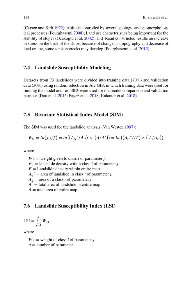
7.5 Bivariate Statistical Index Model (SIM)
The SIM was used for the landslide analysis (Van Westen 1997):
W i j = ln
f i j / f
= ln
A i j
∗
/A i j
×
A/A
∗
= ln
A i j
∗
/A
∗
×
A/A i j
where
W ij = weight given to class i of parameter j.
F ij = landslide density within class i of parameter j.
F = Landslide density within entire map.
A ij
*
= area of landslide in class i of parameter j.
A ij = area of a class i of parameter j.
A
*
= total area of landslide in entire map.
A = total area of entire map.
7.6 Landslide Susceptibility Index (LSI)
LSI =
n
j =1
W i j .
where
W ij = weight of class i of parameter j.
n = number of parameter.
K. Shrestha et al.
(Carson and Kirk 1972); Altitude controlled by several geologic and geomorphological processes (Pourghasemi 2008); Land use characteristics being important for the
stability of slopes (Ocakoglu et al. 2002); and Road constructed results an increase
in stress on the back of the slope, because of changes in topography and decrease of
load on toe, some tension cracks may develop (Pourghasemi et al. 2012).
7.4 Landslide Susceptibility Modeling
Datasets from 73 landslides were divided into training data (70%) and validation
data (30%) using random selection in Arc GIS, in which training data were used for
running the model and rest 30% were used for the model comparison and validation
purpose (Dou et al. 2015; Fayez et al. 2018; Kalantar et al. 2018).
7.5 Bivariate Statistical Index Model (SIM)
The SIM was used for the landslide analysis (Van Westen 1997):
W i j = ln
f i j / f
= ln
A i j
∗
/A i j
×
A/A
∗
= ln
A i j
∗
/A
∗
×
A/A i j
where
W ij = weight given to class i of parameter j.
F ij = landslide density within class i of parameter j.
F = Landslide density within entire map.
A ij
*
= area of landslide in class i of parameter j.
A ij = area of a class i of parameter j.
A
*
= total area of landslide in entire map.
A = total area of entire map.
7.6 Landslide Susceptibility Index (LSI)
LSI =
n
j =1
W i j .
where
W ij = weight of class i of parameter j.
n = number of parameter.