

the Hoshakuji surface (250–260 ka), the Kanuma surface
(145–155 ka), the Okamoto-Ohwada surface (100–110 ka),
the Takaragi surface (40–65 ka), the Minemachi surface
(35–40 ka), the Tawara surface (20–27 ka), and the Kamasusaka surface (13–16 ka). The compilation of a tephra
catalogue for Japan has provided fundamental data such as
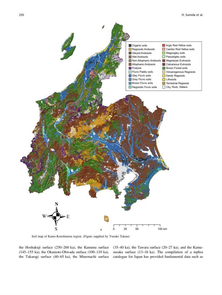
Fig. 7.2 Soil map of Kanto-Koushinetsu region. (Figure supplied by Yusuke Takata)
250
H. Sumida et al.
(145–155 ka), the Okamoto-Ohwada surface (100–110 ka),
the Takaragi surface (40–65 ka), the Minemachi surface
(35–40 ka), the Tawara surface (20–27 ka), and the Kamasusaka surface (13–16 ka). The compilation of a tephra
catalogue for Japan has provided fundamental data such as
Fig. 7.2 Soil map of Kanto-Koushinetsu region. (Figure supplied by Yusuke Takata)
250
H. Sumida et al.