

129
Sensemaking in Practical Design
Survey
After the test voyage and a short debriefing, the six users answered some questions in
a small survey. The first question was whether they thought that the tested prototype
could have any favourable effect on boat navigation. On a scale from 0 to 100, where
0 was “ no favourable effect” and 100 “ large favourable effect”, they were asked to
indicate their answer with a cross. The mean result of all six users was 83, close to
“ large favourable effect”.
The second question dealt with the usability of the prototype application. On the
same type of scale from 0 to 100, where 0 was “ simple to use” and 100 was “ difficult
to use”, they were asked to mark their answer with a cross. The mean result from the
six users was 13, clearly on the “ simple to use side”.
They were also asked to comment on the prototype and asked if they missed any
functions. Three answered “ no”, one gave no answer and the remaining two made
these comments: “ The matching between the AR layer and the camera image could be
better”, “ Automatic Identification System ( AIS) data could be added”, “ Some adjustments and it will be fine”, “ Get it out as soon as you can, new versions can come later”.
During a concurrent television interview ( NRK, 2017), one of the users commented on the alarm function: “ I am often out sailing in my boat and when tacking
we often want to use the water between the islands as much as possible, and then
often go close to land. If we could get an alarm by a buzzer in the pocket instead of
having to constantly look on our navigator screen, that would be great”.
ongoing anD future DeveloPment
The proof- of-concept was successful, but after 2017 the development stopped lacking funding. However, the user group in Ulsteinvik continued testing the app, now
named GrunnVarsel. The area was very limited to the archipelago west of Ulsteinvik
but the user group managed to uncover some important problems not found during
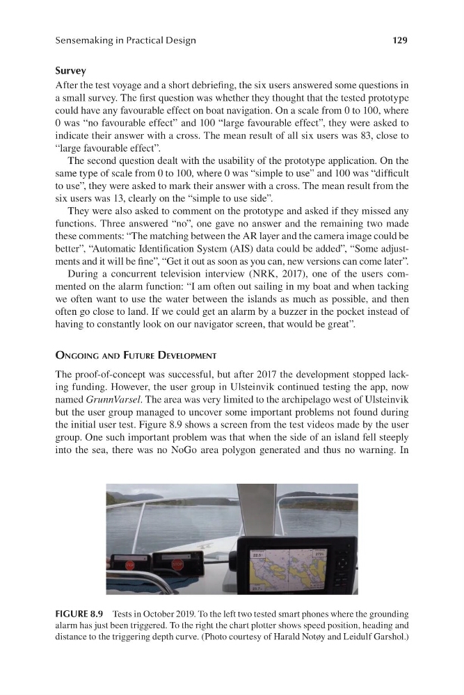
the initial user test. Figure 8.9 shows a screen from the test videos made by the user
group. One such important problem was that when the side of an island fell steeply
into the sea, there was no NoGo area polygon generated and thus no warning. In
FIGURE 8.9 Tests in October 2019. To the left two tested smart phones where the grounding
alarm has just been triggered. To the right the chart plotter shows speed position, heading and
distance to the triggering depth curve. ( Photo courtesy of Harald Notøy and Leidulf Garshol.)
Sensemaking in Practical Design
Survey
After the test voyage and a short debriefing, the six users answered some questions in
a small survey. The first question was whether they thought that the tested prototype
could have any favourable effect on boat navigation. On a scale from 0 to 100, where
0 was “ no favourable effect” and 100 “ large favourable effect”, they were asked to
indicate their answer with a cross. The mean result of all six users was 83, close to
“ large favourable effect”.
The second question dealt with the usability of the prototype application. On the
same type of scale from 0 to 100, where 0 was “ simple to use” and 100 was “ difficult
to use”, they were asked to mark their answer with a cross. The mean result from the
six users was 13, clearly on the “ simple to use side”.
They were also asked to comment on the prototype and asked if they missed any
functions. Three answered “ no”, one gave no answer and the remaining two made
these comments: “ The matching between the AR layer and the camera image could be
better”, “ Automatic Identification System ( AIS) data could be added”, “ Some adjustments and it will be fine”, “ Get it out as soon as you can, new versions can come later”.
During a concurrent television interview ( NRK, 2017), one of the users commented on the alarm function: “ I am often out sailing in my boat and when tacking
we often want to use the water between the islands as much as possible, and then
often go close to land. If we could get an alarm by a buzzer in the pocket instead of
having to constantly look on our navigator screen, that would be great”.
ongoing anD future DeveloPment
The proof- of-concept was successful, but after 2017 the development stopped lacking funding. However, the user group in Ulsteinvik continued testing the app, now
named GrunnVarsel. The area was very limited to the archipelago west of Ulsteinvik
but the user group managed to uncover some important problems not found during
the initial user test. Figure 8.9 shows a screen from the test videos made by the user
group. One such important problem was that when the side of an island fell steeply
into the sea, there was no NoGo area polygon generated and thus no warning. In
FIGURE 8.9 Tests in October 2019. To the left two tested smart phones where the grounding
alarm has just been triggered. To the right the chart plotter shows speed position, heading and
distance to the triggering depth curve. ( Photo courtesy of Harald Notøy and Leidulf Garshol.)