

440
beacon (usually as a URL) to the user holding smart phone. Triangulation and range finding
can be used to more accurately position phones. This same technology can be used to replace
the far more expensive and inflexible reverse Radio Frequency Identification (RFID) technology used to position personnel in today’s mines.
The technology can function as is traditional, where an RFID is sensed by either a fixed
detector at key locations connected to infrastructure, or on mobile detectors, in this case
the smart device. The most common means is through reverse RFID, where the beacons are
placed throughout the mine, broadcasting its ID, which is associated to a known location in
a database in the app. The App then transmits the known location if connected wirelessly, to
a central location, or stores the movement data and sends when there is connectivity.
The BLE technology provides rudimentary range calculations, where the distance between
the beacons can be calculated. Furthermore, since all modern Bluetooth chips have this ability, smart devices can sense the proximity between each other. This means that there is a
situational awareness technology that is built into phones and tablets, allowing anyone with a
tablet to detect the distance from another tablet or a person having a beacon attached. These
beacons can be small, from the size of a coin, to the size of a few AA batteries. Detection
and range-finding capabilities of BLE technology is also different from traditional means.
Tablets can detect each other, as well as detect beacons up to 300 meters away, meaning, it
can sense that there are beacons present, although insufficient signal is available to calculate a distance. When less than 80 meters, the smart device can begin to calculate an actual
distance, albeit with some uncertainty (i.e. ±10 m). Traditional technology can detect that a
beacon is within 200 meters, and some technology exists where a beacon sets of a secondary
Wi-Fi signal when excited by a magnetic field providing an outer and inner zone, but it is still
zonal (i.e. it is somewhere within 30 m) but with greater certainty. Therefore, with BLE, positioning location can be achieved without the need for infrastructure, whereas in the current
technology, continuous connectivity and sensing of beacons are required to position oneself
underground. The tablets can carry all their movements, and detections throughout the day,
trigger their cycles based off the loaded map, therefore have the same level of information,
improved user experience at the face, all without the infrastructure.
A further benefit of this sensing technology is that the tablets, when broadcasting, can
project a small amount of data. In this case, the tablets can broadcast which machine they are
currently logged in as, the status (time code), and the state (what activity they are engaged in
such as hauling full or empty). When a machine changes status, such as going from ‘Ready’,
to a ‘Delay’, the other machines within sensing range, can detect the status change. For example, if a truck is waiting in the queue, and the loader operator breaks down, the truck operators would know immediately. Figure 5 shows the sensing of a machine (unit 304) driving by
other machines (truck 508, loader 327) and static beacon FL4. As can be seen, all interactions, namely entries (begintime) and exits (EndTime) from the detection zones are recorded,
including the state change of hauler 580, and beacon proximity ranges are detected on a
10 second interval, in meters (PointState), the scanning frequency being configurable.
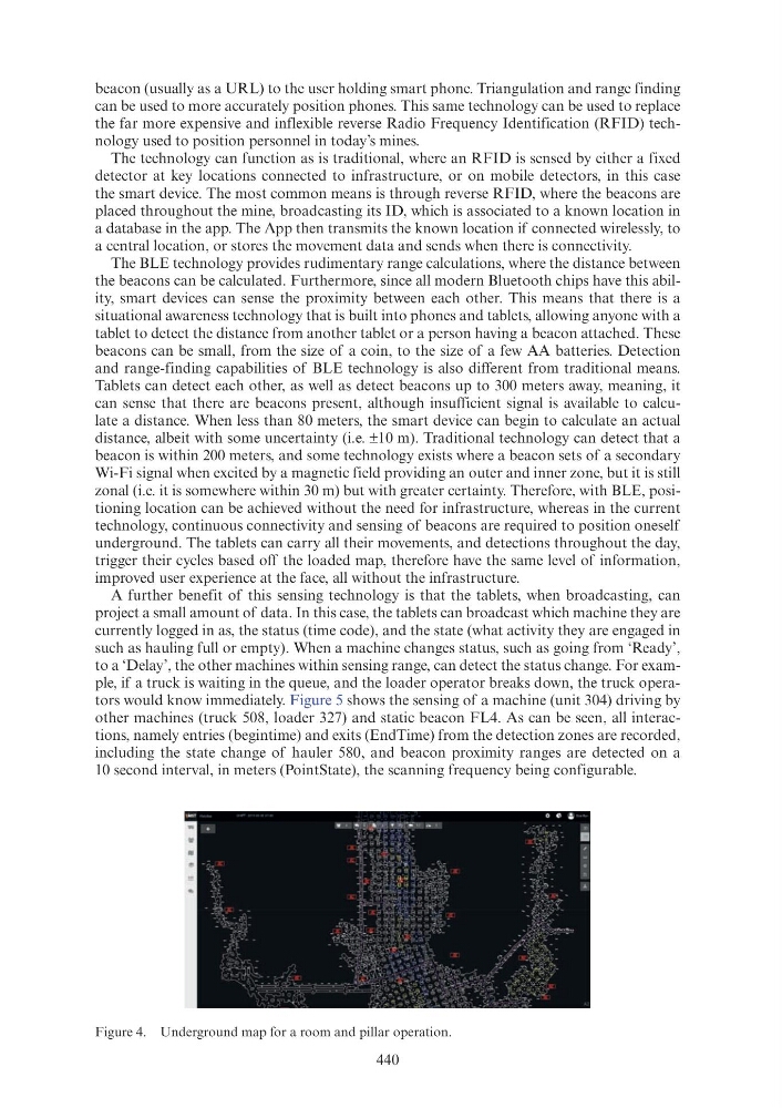
Figure 4. Underground map for a room and pillar operation.
beacon (usually as a URL) to the user holding smart phone. Triangulation and range finding
can be used to more accurately position phones. This same technology can be used to replace
the far more expensive and inflexible reverse Radio Frequency Identification (RFID) technology used to position personnel in today’s mines.
The technology can function as is traditional, where an RFID is sensed by either a fixed
detector at key locations connected to infrastructure, or on mobile detectors, in this case
the smart device. The most common means is through reverse RFID, where the beacons are
placed throughout the mine, broadcasting its ID, which is associated to a known location in
a database in the app. The App then transmits the known location if connected wirelessly, to
a central location, or stores the movement data and sends when there is connectivity.
The BLE technology provides rudimentary range calculations, where the distance between
the beacons can be calculated. Furthermore, since all modern Bluetooth chips have this ability, smart devices can sense the proximity between each other. This means that there is a
situational awareness technology that is built into phones and tablets, allowing anyone with a
tablet to detect the distance from another tablet or a person having a beacon attached. These
beacons can be small, from the size of a coin, to the size of a few AA batteries. Detection
and range-finding capabilities of BLE technology is also different from traditional means.
Tablets can detect each other, as well as detect beacons up to 300 meters away, meaning, it
can sense that there are beacons present, although insufficient signal is available to calculate a distance. When less than 80 meters, the smart device can begin to calculate an actual
distance, albeit with some uncertainty (i.e. ±10 m). Traditional technology can detect that a
beacon is within 200 meters, and some technology exists where a beacon sets of a secondary
Wi-Fi signal when excited by a magnetic field providing an outer and inner zone, but it is still
zonal (i.e. it is somewhere within 30 m) but with greater certainty. Therefore, with BLE, positioning location can be achieved without the need for infrastructure, whereas in the current
technology, continuous connectivity and sensing of beacons are required to position oneself
underground. The tablets can carry all their movements, and detections throughout the day,
trigger their cycles based off the loaded map, therefore have the same level of information,
improved user experience at the face, all without the infrastructure.
A further benefit of this sensing technology is that the tablets, when broadcasting, can
project a small amount of data. In this case, the tablets can broadcast which machine they are
currently logged in as, the status (time code), and the state (what activity they are engaged in
such as hauling full or empty). When a machine changes status, such as going from ‘Ready’,
to a ‘Delay’, the other machines within sensing range, can detect the status change. For example, if a truck is waiting in the queue, and the loader operator breaks down, the truck operators would know immediately. Figure 5 shows the sensing of a machine (unit 304) driving by
other machines (truck 508, loader 327) and static beacon FL4. As can be seen, all interactions, namely entries (begintime) and exits (EndTime) from the detection zones are recorded,
including the state change of hauler 580, and beacon proximity ranges are detected on a
10 second interval, in meters (PointState), the scanning frequency being configurable.
Figure 4. Underground map for a room and pillar operation.