

99
limiting surface exists. We have used a limit of ±5 m, however this can be adjusted based on
both the accuracy of the surface used for limiting the data and the width of the geological
units being identified.
5 CONCLUSIONS
The multivariate GP methodology presented in this paper is capable of automatically identifying unit contacts using MWD data in iron ore mines. Unlike APR based methods, the
approach proposed in this paper can be used to distinguish two geological units that only
have subtle differences in their MWD. We successfully identified both a shale to ore and ore
to ore contact. While the similar properties of the two ore zones causes a lot of data to be
unlabelled, the large amount of data collected allows for useful information to be provided
about the local features of the contact. Therefore the proposed methodology can provide
additional detail about the location of the contact between geological units for modelling.
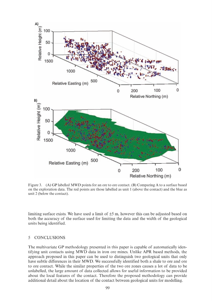
Figure 3. (A) GP labelled MWD points for an ore to ore contact. (B) Comparing A to a surface based
on the exploration data. The red points are those labelled as unit 1 (above the contact) and the blue as
unit 2 (below the contact).
A)
-
5100~------------------~
:E Ol
~ 50
Q)
>
~ 0~----~~~~~~~~~
Q)
0:::
Relative Easting (m)
B)
- _§_ 100
-
.s:::.
Ol
"Qj
50
I
Q)
.2:
:§
0
(l)
c:r
1000
Relative Easting (m)
500
0
200
100
0
Relative Northing (m)
0
200
100
0
Relative Northing (m)
limiting surface exists. We have used a limit of ±5 m, however this can be adjusted based on
both the accuracy of the surface used for limiting the data and the width of the geological
units being identified.
5 CONCLUSIONS
The multivariate GP methodology presented in this paper is capable of automatically identifying unit contacts using MWD data in iron ore mines. Unlike APR based methods, the
approach proposed in this paper can be used to distinguish two geological units that only
have subtle differences in their MWD. We successfully identified both a shale to ore and ore
to ore contact. While the similar properties of the two ore zones causes a lot of data to be
unlabelled, the large amount of data collected allows for useful information to be provided
about the local features of the contact. Therefore the proposed methodology can provide
additional detail about the location of the contact between geological units for modelling.
Figure 3. (A) GP labelled MWD points for an ore to ore contact. (B) Comparing A to a surface based
on the exploration data. The red points are those labelled as unit 1 (above the contact) and the blue as
unit 2 (below the contact).
A)
-
5100~------------------~
:E Ol
~ 50
Q)
>
~ 0~----~~~~~~~~~
Q)
0:::
Relative Easting (m)
B)
- _§_ 100
-
.s:::.
Ol
"Qj
50
I
Q)
.2:
:§
0
(l)
c:r
1000
Relative Easting (m)
500
0
200
100
0
Relative Northing (m)
0
200
100
0
Relative Northing (m)