

7.2
Lithostratigraphy
The formation is the fundamental lithostratigraphic
unit defined in a bedded succession. An important
property of a formation is that it should be easily
recognised in the field or a borehole due to its composition (lithology). The formation is thus a mappable
unit, which can be visualised on an ordinary geological map (scale e.g. 1:50,000) or recognised in the
description of a bedded succession. There is in principle no limit to the thickness of a formation, but it
usually varies from a few tens to several hundred
metres. A 50–300 m thick sandstone, over- and
underlain by quite different rocks such as shale or
limestone, would constitute a natural formation. However, a formation will seldom be homogeneous, and
for more detailed mapping it will be useful to divide
the formation into smaller units. Parts of a sandstone
formation containing shale or conglomerate beds, for
example, can be defined as members of the formation.
The smallest unit in the lithostratigraphic classification is a bed which is assumed to have been deposited by a single depositional process without a break in
sedimentation, and is distinguishable from the beds
above and below. When sections are logged, beds
and other lithological entities are often recorded as
“units”. Units which are <1 cm thick are called
laminae, but this is a purely size-descriptive term.
Most beds/units contain, or may even be entirely
comprised of, laminae. Only when a lamina lies
isolated between significantly different sediments
will it be named, e.g. if it is a thin tephra (ash bed)
or bentonite in a shale succession.
For some purposes it is expedient to group several
formations together into a larger unit called a group. A
group normally consists of three to six formations and
can be divided into two or more subgroups. The largest lithostratigraphic unit is a supergroup, which
consists of two or more groups. This unit is used
when a common name is needed to encompass a
thick sedimentary package.
In sedimentary basins which are partly or entirely
buried in the subsurface, for example the North Sea
basin, lithostratigraphic units like formations and
groups are defined on the basis of records from
wells, such as well logs. In offshore areas where it is
difficult to find enough geographical names to give the
stratigraphic units, other names are then also used,
including historical names, names of animals etc.
7.2.1 Lithostratigraphic Terminology
As research into sedimentary successions expanded, it
required a standardised lithostratigraphic nomenclature that could be applied anywhere. Therefore, a set
of international rules was established for naming
lithostratigraphic units and are summarised below:
1. A stratigraphic unit should preferably be defined
with reference to a type section (stratotype) present
in a good exposure, or in a well where the unit is
adequately represented.
2. Each stratigraphic unit ought to be named after a
geographical site, located preferably near the type
section if exposed on land. Offshore stratigraphic
units may be named after marine features (e.g.
fishing banks), although in the North Sea basin
other names have also been used.
3. The same name ought not to be used for more than
one stratigraphic unit. The unit which is first
defined has priority.
4. Stratigraphic names may consist of a unique name, i.e.
from a locality, and a stratigraphic unit hierarchy
designation, e.g. Kimmeridge Formation or Kimmeridge Clay. In the US many stratigraphic names are
well established even if they do not strictly follow the
international rules for stratigraphic nomenclature.
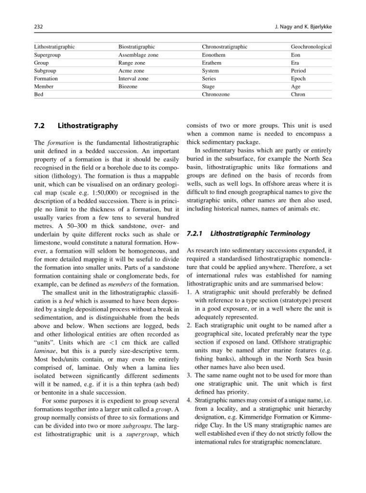
Lithostratigraphic
Biostratigraphic
Chronostratigraphic
Geochronological
Supergroup
Assemblage zone
Eonothem
Eon
Group
Range zone
Erathem
Era
Subgroup
Acme zone
System
Period
Formation
Interval zone
Series
Epoch
Member
Biozone
Stage
Age
Bed
Chronozone
Chron
232
J. Nagy and K. Bjørlykke
Lithostratigraphy
The formation is the fundamental lithostratigraphic
unit defined in a bedded succession. An important
property of a formation is that it should be easily
recognised in the field or a borehole due to its composition (lithology). The formation is thus a mappable
unit, which can be visualised on an ordinary geological map (scale e.g. 1:50,000) or recognised in the
description of a bedded succession. There is in principle no limit to the thickness of a formation, but it
usually varies from a few tens to several hundred
metres. A 50–300 m thick sandstone, over- and
underlain by quite different rocks such as shale or
limestone, would constitute a natural formation. However, a formation will seldom be homogeneous, and
for more detailed mapping it will be useful to divide
the formation into smaller units. Parts of a sandstone
formation containing shale or conglomerate beds, for
example, can be defined as members of the formation.
The smallest unit in the lithostratigraphic classification is a bed which is assumed to have been deposited by a single depositional process without a break in
sedimentation, and is distinguishable from the beds
above and below. When sections are logged, beds
and other lithological entities are often recorded as
“units”. Units which are <1 cm thick are called
laminae, but this is a purely size-descriptive term.
Most beds/units contain, or may even be entirely
comprised of, laminae. Only when a lamina lies
isolated between significantly different sediments
will it be named, e.g. if it is a thin tephra (ash bed)
or bentonite in a shale succession.
For some purposes it is expedient to group several
formations together into a larger unit called a group. A
group normally consists of three to six formations and
can be divided into two or more subgroups. The largest lithostratigraphic unit is a supergroup, which
consists of two or more groups. This unit is used
when a common name is needed to encompass a
thick sedimentary package.
In sedimentary basins which are partly or entirely
buried in the subsurface, for example the North Sea
basin, lithostratigraphic units like formations and
groups are defined on the basis of records from
wells, such as well logs. In offshore areas where it is
difficult to find enough geographical names to give the
stratigraphic units, other names are then also used,
including historical names, names of animals etc.
7.2.1 Lithostratigraphic Terminology
As research into sedimentary successions expanded, it
required a standardised lithostratigraphic nomenclature that could be applied anywhere. Therefore, a set
of international rules was established for naming
lithostratigraphic units and are summarised below:
1. A stratigraphic unit should preferably be defined
with reference to a type section (stratotype) present
in a good exposure, or in a well where the unit is
adequately represented.
2. Each stratigraphic unit ought to be named after a
geographical site, located preferably near the type
section if exposed on land. Offshore stratigraphic
units may be named after marine features (e.g.
fishing banks), although in the North Sea basin
other names have also been used.
3. The same name ought not to be used for more than
one stratigraphic unit. The unit which is first
defined has priority.
4. Stratigraphic names may consist of a unique name, i.e.
from a locality, and a stratigraphic unit hierarchy
designation, e.g. Kimmeridge Formation or Kimmeridge Clay. In the US many stratigraphic names are
well established even if they do not strictly follow the
international rules for stratigraphic nomenclature.
Lithostratigraphic
Biostratigraphic
Chronostratigraphic
Geochronological
Supergroup
Assemblage zone
Eonothem
Eon
Group
Range zone
Erathem
Era
Subgroup
Acme zone
System
Period
Formation
Interval zone
Series
Epoch
Member
Biozone
Stage
Age
Bed
Chronozone
Chron
232
J. Nagy and K. Bjørlykke