

350
Tectonic Control of Fluvial Sedimentation
11"3o· e
KOHAT PLATEAU
33" 00'N
-"" _.,.
KAlABAGH
'--- -. .l fAULT
�? _
hinge zone
----'' " "" '-' ' C: ted to..:.'::'o:'u�t h;_ __-�
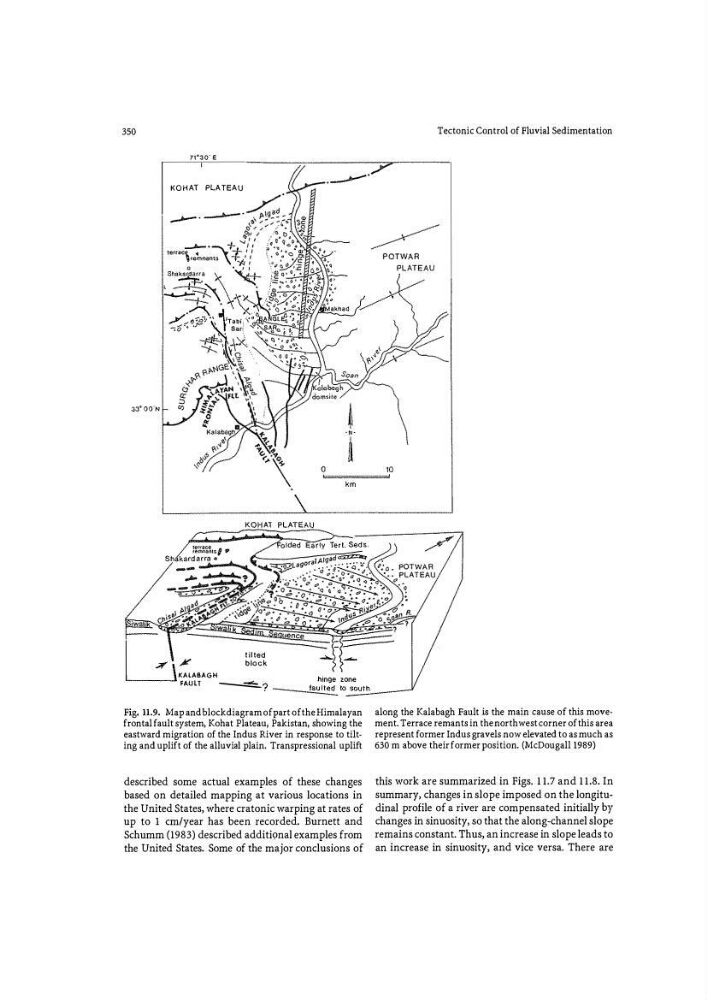
Fig. 11.9. Map and block diagram of part of the Himalayan
frontal fault system, Kohat Plateau, Pakistan, showing the
eastward migration of the Indus River in response to tilting and uplift of the alluvial plain. Transpressional uplift
described some actual examples of these changes
based on detailed mapping at various locations in
the United States, where cratonic warping at rates of
up to 1 em/year has been recorded. Burnett and
Schumm (1983) described additional examples from
the United States. Some of the major conclusions of
along the Kalabagh Fault is the main cause of this movement. Terrace rem ants in the northwest corner of this area
represent former Indus gravels now elevated to as much as
630 m above their former position. (McDougall l989)
this work are summarized in Figs. 11.7 and 11.8. In
summary, changes in slope imposed on the longitudinal profile of a river are compensated initially by
changes in sinuosity, so that the along-channel slope
remains constant. Thus, an increase in slope leads to
an increase in sinuosity, and vice versa. There are
Tectonic Control of Fluvial Sedimentation
11"3o· e
KOHAT PLATEAU
33" 00'N
-"" _.,.
KAlABAGH
'--- -. .l fAULT
�? _
hinge zone
----'' " "" '-' ' C: ted to..:.'::'o:'u�t h;_ __-�
Fig. 11.9. Map and block diagram of part of the Himalayan
frontal fault system, Kohat Plateau, Pakistan, showing the
eastward migration of the Indus River in response to tilting and uplift of the alluvial plain. Transpressional uplift
described some actual examples of these changes
based on detailed mapping at various locations in
the United States, where cratonic warping at rates of
up to 1 em/year has been recorded. Burnett and
Schumm (1983) described additional examples from
the United States. Some of the major conclusions of
along the Kalabagh Fault is the main cause of this movement. Terrace rem ants in the northwest corner of this area
represent former Indus gravels now elevated to as much as
630 m above their former position. (McDougall l989)
this work are summarized in Figs. 11.7 and 11.8. In
summary, changes in slope imposed on the longitudinal profile of a river are compensated initially by
changes in sinuosity, so that the along-channel slope
remains constant. Thus, an increase in slope leads to
an increase in sinuosity, and vice versa. There are