

10
Statistical Methods for Estimating Petroleum Resources
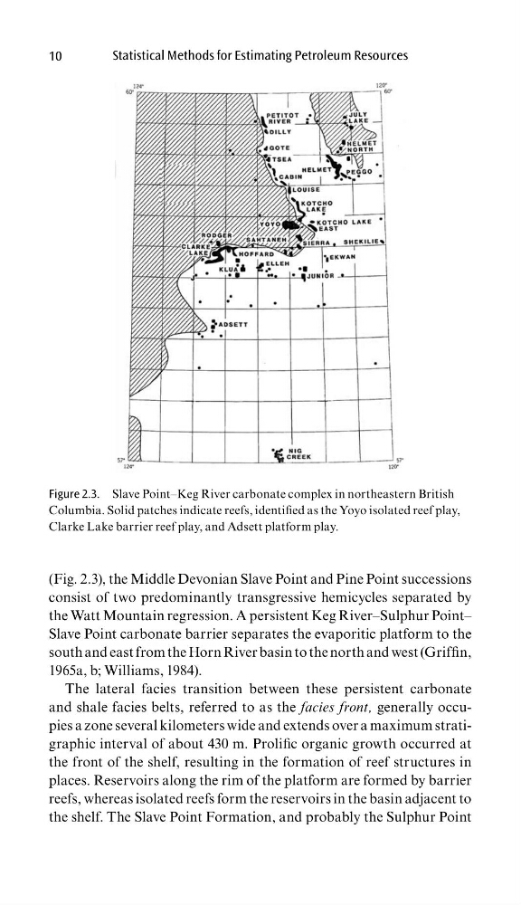
(Fig. 2.3), the Middle Devonian Slave Point and Pine Point successions
consist of two predominantly transgressive hemicycles separated by
the Watt Mountain regression. A persistent Keg River–Sulphur Point–
Slave Point carbonate barrier separates the evaporitic platform to the
south and east from the Horn River basin to the north and west (Griffi n,
1965a, b; Williams, 1984).
The lateral facies transition between these persistent carbonate
and shale facies belts, referred to as the facies front, generally occupies a zone several kilometers wide and extends over a maximum stratigraphic interval of about 430 m. Prolifi c organic growth occurred at
the front of the shelf, resulting in the formation of reef structures in
places. Reservoirs along the rim of the platform are formed by barrier
reefs, whereas isolated reefs form the reservoirs in the basin adjacent to
the shelf. The Slave Point Formation, and probably the Sulphur Point
Figure 2.3. Slave Point–Keg River carbonate complex in northeastern British
Columbia. Solid patches indicate reefs, identifi ed as the Yoyo isolated reef play,
Clarke Lake barrier reef play, and Adsett platform play.
Statistical Methods for Estimating Petroleum Resources
(Fig. 2.3), the Middle Devonian Slave Point and Pine Point successions
consist of two predominantly transgressive hemicycles separated by
the Watt Mountain regression. A persistent Keg River–Sulphur Point–
Slave Point carbonate barrier separates the evaporitic platform to the
south and east from the Horn River basin to the north and west (Griffi n,
1965a, b; Williams, 1984).
The lateral facies transition between these persistent carbonate
and shale facies belts, referred to as the facies front, generally occupies a zone several kilometers wide and extends over a maximum stratigraphic interval of about 430 m. Prolifi c organic growth occurred at
the front of the shelf, resulting in the formation of reef structures in
places. Reservoirs along the rim of the platform are formed by barrier
reefs, whereas isolated reefs form the reservoirs in the basin adjacent to
the shelf. The Slave Point Formation, and probably the Sulphur Point
Figure 2.3. Slave Point–Keg River carbonate complex in northeastern British
Columbia. Solid patches indicate reefs, identifi ed as the Yoyo isolated reef play,
Clarke Lake barrier reef play, and Adsett platform play.