

5.6 Carte du Ciel
83
Henry (1849–1903), usually named Paul and Prosper Henry. The Henry’s were
excellent instrument and telescope builders and soon set to work to improve
the technology for astronomical photography.
In view of the previous section, it will come as no surprise that France also
saw a leading role for itself in this area. With the help of Gill and through him
of Otto Wilhelm von Struve (1819–1905), director of the Pulkovo Observatorium near St Petersburg, Mouchez organized a large congress in Paris in April
1887 to forge plans for an international project to produce a ‘map of the sky’.
All of this under the direction and supervision of France. The objective was not
only a catalog to fainter magnitudes than the Bonner and Cape Photographic
Durchmusterung, but also an atlas (according to Gill at Kapteyn’s suggestion!)
printed on paper.
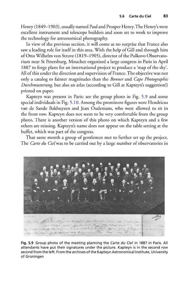
Kapteyn was present in Paris: see the group photo in Fig. 5.9 and some
special individuals in Fig. 5.10. Among the prominent figures were Hendricus
van de Sande Bakhuyzen and Jean Oudemans, who were allowed to sit in
the front row. Kapteyn does not seem to be very comfortable from the group
photo. There is another version of this photo on which Kapteyn and a few
others are missing. Kapteyn’s name does not appear on the table setting at the
buffet, which was part of the congress.
That same month a group of gentlemen met to further set up the project.
The Carte du Ciel was to be carried out by a large number of observatories in
Fig. 5.9 Group photo of the meeting planning the Carte du Ciel in 1887 in Paris. All
attendants have put their signatures under the picture. Kapteyn is in the second row
second from the left. From the archives of the Kapteyn Astronomical Institute, University
of Groningen
83
Henry (1849–1903), usually named Paul and Prosper Henry. The Henry’s were
excellent instrument and telescope builders and soon set to work to improve
the technology for astronomical photography.
In view of the previous section, it will come as no surprise that France also
saw a leading role for itself in this area. With the help of Gill and through him
of Otto Wilhelm von Struve (1819–1905), director of the Pulkovo Observatorium near St Petersburg, Mouchez organized a large congress in Paris in April
1887 to forge plans for an international project to produce a ‘map of the sky’.
All of this under the direction and supervision of France. The objective was not
only a catalog to fainter magnitudes than the Bonner and Cape Photographic
Durchmusterung, but also an atlas (according to Gill at Kapteyn’s suggestion!)
printed on paper.
Kapteyn was present in Paris: see the group photo in Fig. 5.9 and some
special individuals in Fig. 5.10. Among the prominent figures were Hendricus
van de Sande Bakhuyzen and Jean Oudemans, who were allowed to sit in
the front row. Kapteyn does not seem to be very comfortable from the group
photo. There is another version of this photo on which Kapteyn and a few
others are missing. Kapteyn’s name does not appear on the table setting at the
buffet, which was part of the congress.
That same month a group of gentlemen met to further set up the project.
The Carte du Ciel was to be carried out by a large number of observatories in
Fig. 5.9 Group photo of the meeting planning the Carte du Ciel in 1887 in Paris. All
attendants have put their signatures under the picture. Kapteyn is in the second row
second from the left. From the archives of the Kapteyn Astronomical Institute, University
of Groningen