

30
S. Mandal and S. Biswas
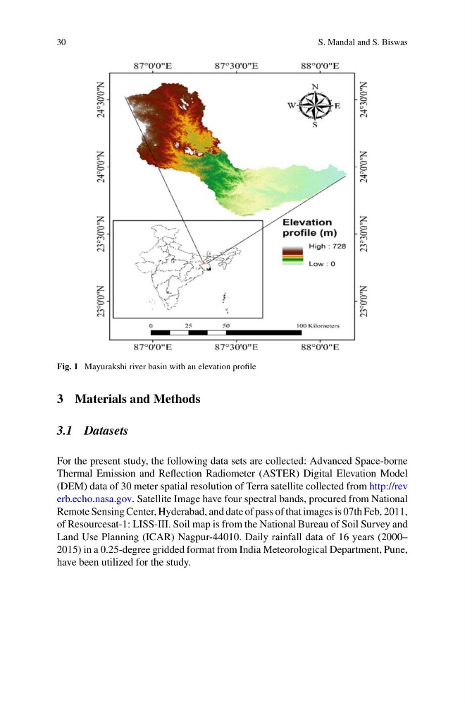
Fig. 1 Mayurakshi river basin with an elevation profile
3 Materials and Methods
3.1 Datasets
For the present study, the following data sets are collected: Advanced Space-borne
Thermal Emission and Reflection Radiometer (ASTER) Digital Elevation Model
(DEM) data of 30 meter spatial resolution of Terra satellite collected from http://rev
erb.echo.nasa.gov. Satellite Image have four spectral bands, procured from National
Remote Sensing Center, Hyderabad, and date of pass of that images is 07th Feb, 2011,
of Resourcesat-1: LISS-III. Soil map is from the National Bureau of Soil Survey and
Land Use Planning (ICAR) Nagpur-44010. Daily rainfall data of 16 years (2000–
2015) in a 0.25-degree gridded format from India Meteorological Department, Pune,
have been utilized for the study.
S. Mandal and S. Biswas
Fig. 1 Mayurakshi river basin with an elevation profile
3 Materials and Methods
3.1 Datasets
For the present study, the following data sets are collected: Advanced Space-borne
Thermal Emission and Reflection Radiometer (ASTER) Digital Elevation Model
(DEM) data of 30 meter spatial resolution of Terra satellite collected from http://rev
erb.echo.nasa.gov. Satellite Image have four spectral bands, procured from National
Remote Sensing Center, Hyderabad, and date of pass of that images is 07th Feb, 2011,
of Resourcesat-1: LISS-III. Soil map is from the National Bureau of Soil Survey and
Land Use Planning (ICAR) Nagpur-44010. Daily rainfall data of 16 years (2000–
2015) in a 0.25-degree gridded format from India Meteorological Department, Pune,
have been utilized for the study.